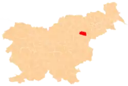
Štajerska Vas | |
|---|---|
 Štajerska Vas Location in Slovenia | |
| Coordinates: 46°18′39.78″N 15°30′46.3″E / 46.3110500°N 15.512861°E | |
| Country | |
| Traditional region | Styria |
| Statistical region | Savinja |
| Municipality | Slovenske Konjice |
| Area | |
| • Total | 0.22 km2 (0.08 sq mi) |
| Elevation | 283.9 m (931.4 ft) |
| Population (2014) | |
| • Total | 40 |
| [1] | |
Štajerska Vas (pronounced [ˈʃtaːjɛɾska ˈʋaːs]; Slovene: Štajerska vas) is a small village in the Municipality of Slovenske Konjice in eastern Slovenia. It lies immediately northeast of Loče. The area is part of the traditional region of Styria and is now included in the Savinja Statistical Region.[2] The settlement of Štajerska Vas was created in 1999, when it was administratively separated from Spodnji Jernej.[3]
Population
Following are 2007 population statistics for Štajerska Vas[4]
| Population | 44 |
| Men | 24 |
| Women | 20 |
| Area | 0.2 km2 |
| Population density | 200/km2 |
| Number of families | 11 |
| Number of households | 11 |
| Average household size | 4 |
| Number of dwellings | 13 |
Following is the population over time:[4]
| 2011 | 2012 | 2013 | 2014 | |
|---|---|---|---|---|
| Population | 41 | 41 | 43 | 40 |
| Men | 19 | 19 | 19 | 16 |
| Women | 22 | 22 | 24 | 24 |
| Population density (pop/km2) |
187 | 187 | 196 | 182 |
References
- ↑ Statistical Office of the Republic of Slovenia
- ↑ Slovenske Konjice municipal site
- ↑ Statistical Office of the Republic of Slovenia. Štajerska vas. (in Slovene)
- 1 2 ŠTAJERSKA VAS, Statistical Office of the Republic of Slovenia
External links
This article is issued from Wikipedia. The text is licensed under Creative Commons - Attribution - Sharealike. Additional terms may apply for the media files.
