| Aberdeen Creek Tributary to Drowning Creek | |
|---|---|
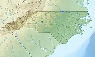
 Location of Aberdeen Creek mouth  Aberdeen Creek (Drowning Creek tributary) (the United States) | |
| Location | |
| Country | United States |
| State | North Carolina |
| County | Moore |
| Town | Aberdeen |
| Village | Pinehurst |
| Physical characteristics | |
| Source | Mill Creek divide |
| • location | about 1 mile east of Pinehurst, North Carolina |
| • coordinates | 35°12′16″N 079°26′02″W / 35.20444°N 79.43389°W[1] |
| • elevation | 472 ft (144 m)[2] |
| Mouth | Drowning Creek |
• location | about 2 miles southwest of Addor, North Carolina |
• coordinates | 35°03′08″N 079°28′27″W / 35.05222°N 79.47417°W[1] |
• elevation | 266 ft (81 m)[2] |
| Length | 12.45 mi (20.04 km)[3] |
| Basin size | 32.63 square miles (84.5 km2)[4] |
| Discharge | |
| • location | Drowning Creek |
| • average | 43.79 cu ft/s (1.240 m3/s) at mouth with Drowning Creek[4] |
| Basin features | |
| Progression | Drowning Creek (Lumber River) → Little Pee Dee River → Pee Dee River → Winyah Bay → Atlantic Ocean |
| River system | Lumber River |
| Tributaries | |
| • left | unnamed tributaries |
| • right | unnamed tributaries |
| Waterbodies | Watson Lake Pages Lake |
| Bridges | US 15-501, Irvernay Road, W Morganton Road, Lake Dornoch Drive (x2), Keith Street, Pinebluff Lake Road, Addor Road |
Aberdeen Creek is a 12.45 mi (20.04 km) long 3rd order tributary to Drowning Creek (Lumber River), in Moore County, North Carolina.
History
Most of the area around Aberdeen Creek was settled by Scots-Irish Immigrants in the 1700s. Historically the major industry was naval stores from the surrounding pine forests, but this has changed to include thriving retirement communities.[5] The creek was named Devil Gut Creek until 1887, when it was changed to Aberdeen Creek.[6]
Variant names
According to the Geographic Names Information System, it has also been known historically as:[1]
- Devil Creek
- Devils Gut Creek
Course
Aberdeen Creek rises on the Mill Creek divide about 1 mile east of Pinehurst in Moore County, North Carolina. Aberdeen Creek then takes a southerly course through numerous swamps to meet Drowning Creek about 2 miles southwest of Addor.[2]
Watershed
Aberdeen Creek drains 32.65 square miles (84.6 km2) of area, receives about 49.3 in/year of precipitation, has a topographic wetness index of 473.33 and is about 29% forested.[4]
See also
Maps
.gif)
.gif)
References
- 1 2 3 "GNIS Detail - Aberdeen Creek". geonames.usgs.gov. US Geological Survey. Retrieved 23 November 2019.
- 1 2 3 "Aberdeen Creek Topo Map, Moore County NC (Pinebluff Area)". TopoZone. Locality, LLC. Retrieved 23 November 2019.
- ↑ "ArcGIS Web Application". epa.maps.arcgis.com. US EPA. Retrieved 22 November 2019.
- 1 2 3 "Aberdeen Creek Watershed Report". Waters Geoviewer. US EPA. Retrieved 23 November 2019.
- ↑ "History of Aberdeen - Aberdeen NC". townofaberdeen.net. Town of Aberdeen. Retrieved 23 November 2019.
- ↑ Carolina, North (1887). "Laws and Resolutions of the State of North Carolina". Google Books. NC General Assembly. Retrieved 23 November 2019.