| Aberhosan | |
|---|---|
 Viewed from near Ty-gwyn farm | |
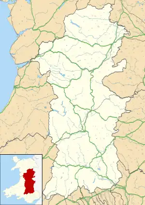
 Aberhosan Location within Powys | |
| OS grid reference | SN811973 |
| Community | |
| Principal area | |
| Preserved county | |
| Country | Wales |
| Sovereign state | United Kingdom |
| Post town | MACHYNLLETH |
| Postcode district | SY20 |
| Dialling code | 01654 |
| Police | Dyfed-Powys |
| Fire | Mid and West Wales |
| Ambulance | Welsh |
| UK Parliament | |
| Senedd Cymru – Welsh Parliament | |
Aberhosan (ⓘ) is a village in the Welsh principal area of Powys, located between the town of Machynlleth and village of Dylife. It is in the historic county of Montgomeryshire.
History
The village school closed before 1971,[1] and is now the village hall. The village has a chapel but its shop has closed.
Wynford Vaughan-Thomas

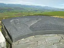
In 1990 a memorial was unveiled at the Cadair viewpoint (at 52°32′56″N 3°43′06″W / 52.5489°N 3.7183°W) to the broadcaster and writer Wynford Vaughan-Thomas. It is a toposcope, looking out over the rolling hills and mountains, with a depiction of Vaughan-Thomas pointing towards Snowdon, Wales' highest peak, which is just visible on a clear day.[2]
Internet issues
In September 2020 the BBC reported that the village had had serious issues with its broadband internet connectivity for the previous 18 months. BT Openreach engineers investigated the problem using a spectrum analyser and found that the issue was caused by a resident who was using an old television. After the TV was disposed of the issues ended.[3]
References
- ↑ "Ysgol Glantwymyn School Prospectus" (PDF). powys.sch.uk/.
- ↑ "History aberhosan". Archived from the original on 6 August 2009. Retrieved 2008-04-16. Across the hills towards Yr Wyddfa and the Snowdonia National Park
- ↑ "Internet: Old TV caused village broadband outages for 18 months". BBC News. 22 September 2020.
External links
- Photos of Aberhosan and surrounding area on geograph
- https://thenextweb.com/insights/2020/09/22/old-tv-breaks-internet-village/
