Abirim
אַבִּירִים | |
|---|---|
 | |
| Etymology: Knights | |
 Abirim  Abirim | |
| Coordinates: 33°2′22″N 35°17′15″E / 33.03944°N 35.28750°E | |
| Country | |
| District | Northern |
| Council | Ma'ale Yosef |
| Founded | 1980 |
| Population (2021)[1] | 296 |
| Website | abirim.info |

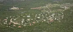
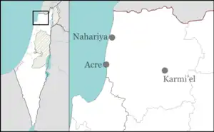
Abirim (Hebrew: אַבִּירִים, lit. 'Knights'), also known as Mitzpe Abirim, is a community settlement in northern Israel. Located in the Upper Galilee, three kilometres from Ma'alot-Tarshiha, it falls under the jurisdiction of Ma'ale Yosef Regional Council. In 2021 it had a population of 296.[1] It is located in the middle of a natural oak forest bordering the Nahal Kziv nature reserve.
History
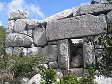
Abirim was established in 1980 and was initially named "Eder" and then renamed to "Abirim" after the nearby ruins of Burj Misr (Arabic: "Egyptian Tower"), which was renamed to Horbat Metsad Abirim (Hebrew: "Ruin of the Fortress of the Knights") in 1957.[2] The age and original purpose of the ruins is unknown; proposals range from a Crusader stronghold to a mausoleum from the Hellenistic period (4th–3rd centuries BCE).[3][4] Abirim is located on land that had belonged to the Palestinian villages of Dayr al-Qassi and al-Mansura, both of which were depopulated in the 1948 Arab–Israeli War.[5]
See also
References
- 1 2 "Regional Statistics". Israel Central Bureau of Statistics. Retrieved 22 February 2023.
- ↑ Government of Israel, ילקוט הפרסומים (Gazette) number 536, 14 May 1957, p. 856.
- ↑ Asher Ovadieh; Yinon Shivtiel (2016). "The caves in the cliff shelters of Keziv Stream (Nahal Keziv) and the relief of 'The Man in the Wall'". Liber Annuus. 66: 351–375. doi:10.1484/J.LA.4.2018015.
- ↑ Denys Pringle (1997). Secular Buildings in the Crusader Kingdom of Jerusalem. Cambridge University Press. p. 43.
- ↑ Khalidi, Walid (1992), All That Remains: The Palestinian Villages Occupied and Depopulated by Israel in 1948, Washington D.C.: Institute for Palestine Studies, pp. 13, 24, ISBN 0-88728-224-5