Abney Crossroads, South Carolina | |
|---|---|
 Abney Crossroads  Abney Crossroads | |
| Coordinates: 34°30′32″N 80°30′48″W / 34.50889°N 80.51333°W | |
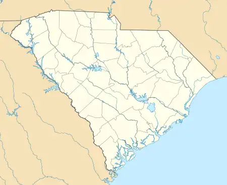
| Country | United States |
| State | South Carolina |
| County | Kershaw |
| Area | |
| • Total | 0.46 sq mi (1.18 km2) |
| • Land | 0.46 sq mi (1.18 km2) |
| • Water | 0.00 sq mi (0.00 km2) |
| Elevation | 405 ft (123 m) |
| Population | |
| • Total | 101 |
| • Density | 221.98/sq mi (85.69/km2) |
| Time zone | UTC-5 (Eastern (EST)) |
| • Summer (DST) | UTC-4 (EDT) |
| ZIP Code | 29067 (Kershaw) |
| Area codes | 803/839 |
| FIPS code | 45-00165 |
| GNIS feature ID | 2812969[3] |
Abney Crossroads is an unincorporated community and census-designated place (CDP) in Kershaw County, South Carolina, United States. It was first listed as a CDP prior to the 2020 census.[3]
The CDP is in northern Kershaw County, along South Carolina Highway 341, which leads northwest 5 miles (8 km) to Kershaw and southeast 12 miles (19 km) to Bethune.
Demographics
| Census | Pop. | Note | %± |
|---|---|---|---|
| 2020 | 101 | — | |
| U.S. Decennial Census[4] | |||
References
- ↑ "ArcGIS REST Services Directory". United States Census Bureau. Retrieved October 15, 2022.
- ↑ "Census Population API". United States Census Bureau. Retrieved October 15, 2022.
- 1 2 "Abney Crossroads Census Designated Place". Geographic Names Information System. United States Geological Survey, United States Department of the Interior.
- ↑ "Census of Population and Housing". Census.gov. Retrieved June 4, 2016.
Municipalities and communities of Kershaw County, South Carolina, United States | ||
|---|---|---|
| City | 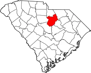 Map of South Carolina highlighting Kershaw County | |
| Towns | ||
| CDPs | ||
| Other communities | ||
This article is issued from Wikipedia. The text is licensed under Creative Commons - Attribution - Sharealike. Additional terms may apply for the media files.