Acton, Montana | |
|---|---|
 Acton, Montana  Acton, Montana | |
| Coordinates: 45°55′50″N 108°40′51″W / 45.93056°N 108.68083°W | |
| Country | United States |
| State | Montana |
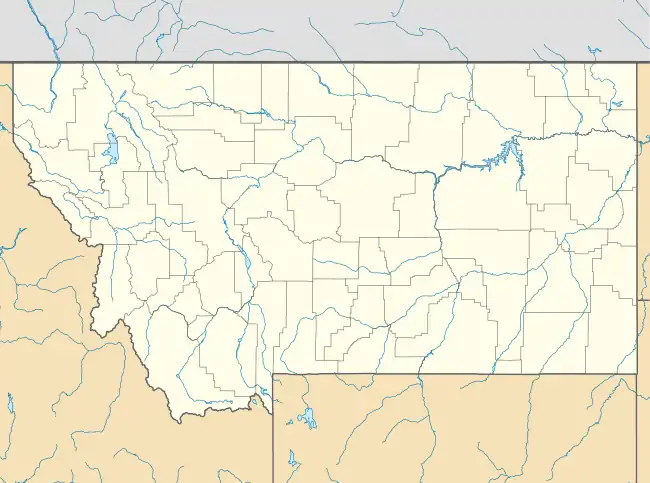
| County | Yellowstone |
| Area | |
| • Total | 0.24 sq mi (0.62 km2) |
| • Land | 0.24 sq mi (0.62 km2) |
| • Water | 0.00 sq mi (0.00 km2) |
| Elevation | 3,806 ft (1,160 m) |
| Population (2020) | |
| • Total | 48 |
| • Density | 200.00/sq mi (77.37/km2) |
| Time zone | UTC-7 (Mountain (MST)) |
| • Summer (DST) | UTC-6 (MDT) |
| ZIP code | 59002 |
| Area code | 406 |
| GNIS feature ID | 2804624[2] |
Acton is an Census Designated Place in northwestern Yellowstone County, Montana, United States.[2] It has a postal ZIP code (59002) and lies along Montana Highway 3 northwest of the city of Billings, the county seat of Yellowstone County.[3]
History
Acton is a small farming community which originated as a stop on the Great Northern Railroad. The post office was opened in 1910.[4] Charles T. Robinson served as the original postmaster.
The village experienced a small boom with the opening of the Yellowstone Drag Strip race facility, six miles due west of the old train stop. The depot and elevators are no longer active.
Demographics
| Census | Pop. | Note | %± |
|---|---|---|---|
| 2020 | 48 | — | |
| U.S. Decennial Census[5] | |||
Climate
According to the Köppen Climate Classification system, Acton has a semi-arid climate, abbreviated "BSk" on climate maps.[6]
| Climate data for Acton, Montana | |||||||||||||
|---|---|---|---|---|---|---|---|---|---|---|---|---|---|
| Month | Jan | Feb | Mar | Apr | May | Jun | Jul | Aug | Sep | Oct | Nov | Dec | Year |
| Mean daily maximum °C (°F) | 1 (33) |
4 (39) |
8 (46) |
14 (57) |
19 (67) |
25 (77) |
31 (87) |
29 (85) |
23 (73) |
16 (60) |
7 (45) |
2 (36) |
15 (59) |
| Mean daily minimum °C (°F) | −10 (14) |
−7 (19) |
−4 (25) |
1 (34) |
6 (43) |
11 (52) |
14 (58) |
14 (57) |
8 (47) |
3 (37) |
−3 (26) |
−8 (18) |
2 (36) |
| Average precipitation mm (inches) | 18 (0.7) |
15 (0.6) |
28 (1.1) |
46 (1.8) |
58 (2.3) |
53 (2.1) |
28 (1.1) |
23 (0.9) |
33 (1.3) |
30 (1.2) |
18 (0.7) |
15 (0.6) |
360 (14.3) |
| Source: Weatherbase [7] | |||||||||||||
References
- ↑ "ArcGIS REST Services Directory". United States Census Bureau. Retrieved September 5, 2022.
- 1 2 3 U.S. Geological Survey Geographic Names Information System: Acton, Montana
- ↑ The Road Atlas '09. Chicago: Rand McNally, 2009, 61.
- ↑ Carkeek Cheney, Roberta (1983). Names on the Faces of Montana (2 ed.). Missoula, Montana: Mountain Press. ISBN 0-87842-150-5.
- ↑ "Census of Population and Housing". Census.gov. Retrieved June 4, 2016.
- ↑ Climate Summary for Acton, Montana
- ↑ "Weatherbase.com". Weatherbase. 2013. Retrieved on September 24, 2013.
Municipalities and communities of Yellowstone County, Montana, United States | ||
|---|---|---|
| Cities | 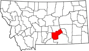 Yellowstone County map | |
| Town | ||
| CDPs | ||
| Other communities | ||
| Indian reservation | ||
| Ghost towns | ||
| Footnotes | ‡This populated place also has portions in an adjacent county or counties | |
This article is issued from Wikipedia. The text is licensed under Creative Commons - Attribution - Sharealike. Additional terms may apply for the media files.