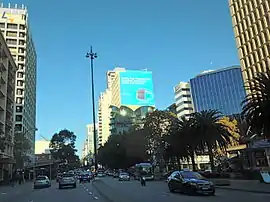
Adelaide Terrace | |
|---|---|
 | |
| View down Adelaide Terrace | |
| General information | |
| Type | Road |
| Length | 1.3 km (0.8 mi)[1] |
| Major junctions | |
| East end |
|
| |
| West end | |
| Location(s) | |
| Major suburbs | East Perth, Perth |
Adelaide Terrace is a major arterial road through the central business district of Perth, Western Australia. It runs parallel to the Swan River, linking St Georges Terrace with The Causeway.
Route description
Adelaide Terrace's eastern end is at The Causeway, adjacent to the Swan River. It travels in a west-north-westerly, intersecting perpendicular roads in Perth's grid plan, which are spaced 300 to 400 metres (980 to 1,310 ft) apart. All intersections are traffic light controlled, except for a couple of minor streets. The road's western end joins onto St Georges Terrace, at an intersection with Victoria Avenue.[1]
History
Adelaide Terrace has existed since the 1830s.[2] Its name appears for the first time on maps of the Land Department in 1838.[3] It is named after Queen Adelaide, consort of King William IV, who reigned from 1830 to 1837.[4][5]
In the late nineteenth century, the southern side was lined by houses and properties of wealthy and powerful people in Western Australia of the time – and it earned the reputation of being the location of some of John Horgan's six hungry families.
By the late twentieth century, there were only a couple of houses from the nineteenth century remaining in the full length of the road.
Major intersections
All major intersections are traffic light controlled.
| LGA | Location | km | mi | Destinations | Notes |
|---|---|---|---|---|---|
| Perth | East Perth | 0 | 0.0 | Eastern terminus at traffic light controlled teardrop roundabout: No access from Hay Street, no access to Riverside Drive. | |
| 0.3 | 0.19 | De Vlamingh Avenue | |||
| 0.4 | 0.25 | Traffic light controlled. No right turns permitted from Plain Street during peak hour. Access to Graham Farmer Freeway. | |||
| 0.7 | 0.43 | Bennett Street | Traffic light controlled. | ||
| 0.9 | 0.56 | Burt Way | |||
| East Perth–Perth boundary | 1.0 | 0.62 | Hill Street | Traffic light controlled. Traffic cannot access Hill Street northbound due to southbound one-way operation. | |
| Perth | 1.3 | 0.81 | Victoria Avenue – Highgate, Mount Lawley | Western terminus, continues as St Georges Terrace westbound. Traffic light controlled. Victoria Avenue is one-way northbound north of intersection. | |
| 1.000 mi = 1.609 km; 1.000 km = 0.621 mi | |||||
See also
Notes
- 1 2 Google (14 August 2013). "Adelaide Terrace" (Map). Google Maps. Google. Retrieved 14 August 2013.
- ↑ "GOVERNMENT NOTICE". The Perth Gazette and Western Australian Journal. WA: National Library of Australia. 27 April 1833. p. 65. Retrieved 15 August 2013.
- ↑ "PERTH STREETS". Sunday Times (Perth). No. 1645. Western Australia. 4 August 1929. p. 12 (Second Section). Retrieved 21 August 2020 – via National Library of Australia.
- ↑ "Street Names Tell Perth's History". The Daily News. Perth: National Library of Australia. 3 August 1935. p. 18 Edition: LATE CITY. Retrieved 15 August 2013.
- ↑ "Origins Of Street Names In Perth" (PDF). Western Australian Land Information Authority. Archived from the original (PDF) on 12 December 2013. Retrieved 14 August 2013.