Adelsried | |
|---|---|
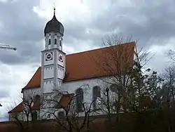 Church of Saint John the Baptist | |
 Coat of arms | |
Location of Adelsried within Augsburg district 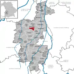 | |
 Adelsried 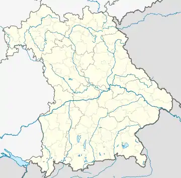 Adelsried | |
| Coordinates: 48°25′N 10°43′E / 48.417°N 10.717°E | |
| Country | Germany |
| State | Bavaria |
| Admin. region | Schwaben |
| District | Augsburg |
| Government | |
| • Mayor (2020–26) | Sebastian Bernhard[1] (CSU) |
| Area | |
| • Total | 9.7 km2 (3.7 sq mi) |
| Elevation | 485 m (1,591 ft) |
| Population (2022-12-31)[2] | |
| • Total | 2,552 |
| • Density | 260/km2 (680/sq mi) |
| Time zone | UTC+01:00 (CET) |
| • Summer (DST) | UTC+02:00 (CEST) |
| Postal codes | 86477 |
| Dialling codes | 08294 |
| Vehicle registration | A |
| Website | www.adelsried.de |
Adelsried is a municipality in the district of Augsburg in Bavaria in Germany.
Location
Adelsried is located on the edge of the swabic Holzwinkel in Naturpark Augsburg – Western Forests in Landkreis Augsburg and around 20 km from Augsburg.
The Holzwinkel locked in 5 suburbs of Adelsried, Bonstetten, Heretsried, Welden and Emersacker. It is a densely forested area.
Parts
- Adelsried, Mainarea,
- Kruichen, Village
- Engelshof, wasteland
References
- ↑ Liste der ersten Bürgermeister/Oberbürgermeister in kreisangehörigen Gemeinden, Bayerisches Landesamt für Statistik, 15 July 2021.
- ↑ Genesis Online-Datenbank des Bayerischen Landesamtes für Statistik Tabelle 12411-003r Fortschreibung des Bevölkerungsstandes: Gemeinden, Stichtag (Einwohnerzahlen auf Grundlage des Zensus 2011)
This article is issued from Wikipedia. The text is licensed under Creative Commons - Attribution - Sharealike. Additional terms may apply for the media files.