Afuá | |
|---|---|
Municipality | |
.jpg.webp) | |
 Flag  Seal | |
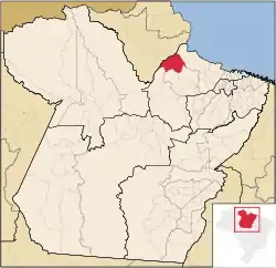 Location in the State of Pará | |
| Coordinates: 00°09′25″S 50°23′13″W / 0.15694°S 50.38694°W | |
| Country | |
| Region | North |
| State | |
| Founded | August 2, 1891 |
| Area | |
| • Total | 8,372.772 km2 (3,232.745 sq mi) |
| Elevation | 8 m (26 ft) |
| Population (2020 [1]) | |
| • Total | 39,567 |
| • Density | 4.4/km2 (11/sq mi) |
| Time zone | UTC−3 (BRT) |
| Postal Code | 68890-000 |
Afuá is a Brazilian municipality located in the state of Pará. Its population as of 2020 is estimated to be 39,567 people. The area of the municipality is 8,372.772 km2. The city belongs to the mesoregion Marajó and to the microregion of Furos de Breves.
The municipality is contained in the 59,985-square-kilometre (23,160 sq mi) Marajó Archipelago Environmental Protection Area, a sustainable use conservation unit established in 1989 to protect the environment of the delta region.[2] The municipal seat lies at the mouth of the Cajari River where it enters the Baía do Vieira Grande. The municipality contains the 65,181 hectares (161,070 acres) Charapucu State Park, a strictly protected conservation unit created in 2010.[3]
References
Wikimedia Commons has media related to Afuá.
- ↑ IBGE 2020
- ↑ APA Arquipélago do Marajó (in Portuguese), ISA: Instituto Socioambiental, retrieved 2016-06-27
- ↑ PES Charapucu (in Portuguese), ISA: Instituto Socioambiental, retrieved 2016-06-30
Capital: Belém | |||||||||||||||
| Mesoregion Lower Amazonas |
|  | |||||||||||||
| Mesoregion Marajó |
| ||||||||||||||
| Mesoregion Metropolitan Belém |
| ||||||||||||||
| Mesoregion Northeastern Pará |
| ||||||||||||||
| Mesoregion Southeastern Pará |
| ||||||||||||||
| Mesoregion Southwestern Pará |
| ||||||||||||||
This article is issued from Wikipedia. The text is licensed under Creative Commons - Attribution - Sharealike. Additional terms may apply for the media files.