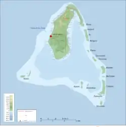
Topographic map of Aitutaki

Sunset from Akaiami, Cook Islands
Akaiami is one of 22 islands in the Aitutaki atoll of the Cook Islands. It is located on the eastern perimeter of Aitutaki Lagoon to the north of the smaller islands of Muritapua, five kilometres to the southeast of the main island of Aitutaki. It is the second-largest of the Aitutaki motus, after Tekopua, measuring 1120m long and 410m wide.[1] During the 1950s the island was used as a stopover for TEAL (Tasman Empire Airways Limited) flying boats on the famous Coral Route.[2] These operations ceased in 1960, and the only reminder are the remains of the purpose-built jetty.[3]
References
- ↑ D. R. Stoddart (13 August 1975). "Reef Islands of Aitutaki". In D.R. Stoddard and P.E. Gibbs (ed.). Atoll Research Bulletin No 190, Almost-Atoll of Aitutaki, Reef Studies in the Cook Islands, South Pacific (PDF). Smithsonian Institution. pp. 65–66. Archived from the original (PDF) on 18 September 2009. Retrieved 4 August 2020.
- ↑ "TEAL's Coral Route Stopover at Aitutaki". Cookislandsbooking.com. Archived from the original on 19 May 2021. Retrieved 30 July 2020.
- ↑ "Remembering the days of the fabulous Coral Route". Cook Islands News. 7 July 2018. Retrieved 4 August 2020.
18°54′22″S 159°43′46″W / 18.9061°S 159.7295°W
This article is issued from Wikipedia. The text is licensed under Creative Commons - Attribution - Sharealike. Additional terms may apply for the media files.