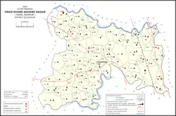
Akhand Nagar is a community development block in Kadipur tehsil of Sultanpur district, Uttar Pradesh, India.[1] It consists of 106 inhabited villages with a total population of 168,686 people in 25,112 households.[1]
Akhand Nagar situated in 22 km east of Kadipur and is connected with Kadipur, Dostpur, Bilwai, Mohadi Sarai and Baramadpur. It has a police station on Kadipur Road and a petrol pump at Bilwai Road. The block office and electric power house are situated at Kadipur Road. There are two government banks – Bank of Baroda and State bank of India. One primary school for the primary education and a junior school up to 8th class.
Demographics
As of 2011, Akhand Nagar CD block has a population of 168,686 people, in 25,112 households.[1] This population includes 84,863 males and 83,823 females.[1] The corresponding sex ratio of 988 females to every 1000 males is slightly higher than the district rural average of 987.[1] Members of the 0-6 age group numbered 24,441 as of 2011, or about 14.5% of the total.[1] The sex ratio of this group is 909, which is somewhat lower than the district rural average of 923.[1] Members of Scheduled Castes numbered 47,572, or 28.20% of the total population (one of the highest proportions in the district); while members of Scheduled Tribes numbered 36, or 0.02% of the total.[1] The literacy rate of Akhand Nagar block as of 2011 is 70.1% (counting only people age 7 and up); literacy is higher among men and boys (80.78%) than among women and girls (59.44%).[1] The Scheduled Castes literacy rate as of the same year is 63.77% (74.96% among men and boys and 52.46% among women and girls).[1]
In terms of employment, 20.30% of Akhand Nagar block residents were classified as main workers (i.e. people employed for at least 6 months per year) in 2011.[1] Marginal workers (i.e. people employed for less than 6 months per year) made up 11.51%, and the remaining 68.19% were non-workers.[1] Employment status varied significantly according to gender, with 44.57% of men being either main or marginal workers, compared to only 18.88% of women.[1]
Agriculture is the predominant source of employment in Akhand Nagar block: 40.34% of the block's workers were cultivators who owned or leased their own land as of 2011, and a further 37.92% were agricultural labourers who worked someone else's land for wages.[1] Another 3.01% were counted as household industry workers, and the remaining 18.73% were other workers.[1] The block had the highest proportion of cultivators and lowest proportion of household industry workers in the district.[1]
According to the 2001 census, the population of Akhand Nagar is 199,489[2] and the literacy rate is 55.64%.
Villages
Akhand Nagar CD block has the following 106 villages:[1]
| Village name | Total land area (hectares) | Population (in 2011) |
|---|---|---|
| Paharpur Bastipur | 404.3 | 5,703 |
| Sansarpur | 146.6 | 1,472 |
| Jaalalpur | 185.8 | 1,593 |
| Jaunara | 84.9 | 1,309 |
| Golhanpara | 154.5 | 1,008 |
| Sahigia | 189.4 | 1,348 |
| Pasiyapara | 153.5 | 1,793 |
| Bhagati | 125.5 | 637 |
| Naranpur Kalan | 341.1 | 1,727 |
| Masuran | 121.6 | 1,851 |
| Lokhathpur | 198 | 2,672 |
| Domapur | 500.2 | 2,218 |
| Kamiya Bahauddinpur | 120.9 | 757 |
| Rampur Jariya | 89.7 | 458 |
| Paudhanpur | 378.2 | 2,941 |
| Udari | 285.1 | 1,951 |
| Paharpur Sarpur | 38.3 | 506 |
| Hasanpur Taini | 173.8 | 1,665 |
| Baluaa | 84.3 | 1,162 |
| Misirpur Jamalpur | 137.9 | 1,789 |
| Hajipur Biri | 801.7 | 3,902 |
| Maruikishun Daspur | 323.8 | 2,208 |
| Umari | 260.9 | 2,189 |
| Dahula Khor | 58.9 | 232 |
| Ahirifiroj Pur | 254.7 | 1,809 |
| Ramnagar Sothiya | 75.1 | 528 |
| Bara Gaon | 156.7 | 591 |
| Jarauddinpur | 67.7 | 408 |
| Parabasoopur | 138.3 | 1,068 |
| Baraura Khwajapur | 353.8 | 2,398 |
| Pasna | 121.3 | 844 |
| Pajjoonpaharpur | 323.4 | 2,606 |
| Sekhauli | 82.2 | 553 |
| Jagudishpur | 194.6 | 948 |
| Brahimpur | 303.4 | 2,171 |
| Undorkha | 326.1 | 2,172 |
| Pattipipari | 167.8 | 1,516 |
| Khakhra | 27 | 276 |
| Jamalpur | 105.2 | 899 |
| Mahmoodpur | 244.9 | 1,755 |
| Misirpur Dhekaha | 165.7 | 1,278 |
| Saraiyamubarakpur | 125 | 1,188 |
| Alimuddinpur | 90.1 | 870 |
| Hajipur | 94.5 | 471 |
| Gidhauna | 177.4 | 1,401 |
| Losdha | 87.8 | 449 |
| Allipurkanpa | 229.5 | 2,145 |
| Aniudhapur | 206.5 | 1,112 |
| Bahauddipur | 61.9 | 888 |
| Tikari | 81.7 | 1,047 |
| Narwari | 139 | 1,812 |
| Bhairopur | 70 | 555 |
| Saranwa | 200.2 | 1,721 |
| Dadoopur | 120.9 | 652 |
| Kundabharopur | 194.9 | 2,289 |
| Chandipur | 179.4 | 481 |
| Baksara | 96.7 | 966 |
| Kalyanpur | 99.9 | 879 |
| Mahroopur | 80.4 | 770 |
| Salhoopara | 93.9 | 1,179 |
| Ratanpur | 145.3 | 1,029 |
| Saidpur | 55.7 | 28 |
| Barisahija | 210.2 | 1,493 |
| Tazddinpur | 478.3 | 3,841 |
| Harthuaa Babhanpur | 196.7 | 2,008 |
| Mauna | 213.4 | 604 |
| Faridpur | 559.4 | 3,857 |
| Jafarpur | 98.9 | 744 |
| Baharmapur | 119.2 | 765 |
| Gopalpur | 76.4 | 717 |
| Dasaoopur | 69.9 | 2,796 |
| Lorpur | 126.1 | 1,618 |
| Prannathpur Bachhariya | 313.1 | 2,941 |
| Bahrabhari | 297.9 | 2,845 |
| Jagdishpur | 129.9 | 1,193 |
| Alaauddinpur | 132.3 | 1,344 |
| Sahatpur | 223.4 | 1,051 |
| Khushamadpur | 108.1 | 861 |
| Nagari | 399.8 | 2,672 |
| Hakimpur | 166.4 | 1,214 |
| Kanakpur | 137 | 1,122 |
| Banganwadih | 552.1 | 4,167 |
| Ramnagar | 114.8 | 983 |
| Raypur | 270.2 | 1,738 |
| Ghurahoopur | 26.2 | 10 |
| Karai | 136.8 | 1,399 |
| Kotiya | 69 | 400 |
| Chamaroopur | 70.1 | 552 |
| Muradabad | 161.3 | 1,543 |
| Baramadpur | 350.6 | 3,251 |
| Sajampur | 275.8 | 1,749 |
| Banbahasirkhinpur | 526.9 | 3,157 |
| Kalwari Bagh | 183.3 | 336 |
| Bhelara | 385.8 | 3,656 |
| Bhiura | 122.2 | 1,045 |
| Harpur | 316.1 | 3,656 |
| Patarkhas | 235.8 | 2,321 |
| Khwajarawpur | 71.6 | 96 |
| Ghatampur | 115.5 | 956 |
| Belwaiamadhaupur | 191.4 | 1,896 |
| Khanpur Kalan | 64.3 | 413 |
| Rupaipur | 242.5 | 2,219 |
| Khanpur Pilai | 256.1 | 1,664 |
| Fajullapur | 98.5 | 752 |
| Mirpur | 1,025.2 | 7,077 |
| Kalan | 280.4 | 3,082 |
References