al-Malihah Subdistrict
ناحية المليحة | |
|---|---|
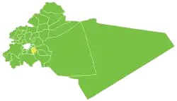 Location of Malihah Subdistrict within Rif Dimashq Governorate | |
| Coordinates: 33°29′05″N 36°22′27″E / 33.4846816°N 36.3741446°E | |
| Country | |
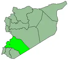
| Governorate | Rif Dimashq |
| District | Markaz Rif Dimashq District |
| Seat | Al-Malihah |
| Area | |
| • Total | 74.51 km2 (28.77 sq mi) |
| Population (2004)[1] | 56,652 |
| Demonym | Malihawi |
| Geocode | SY030104 |
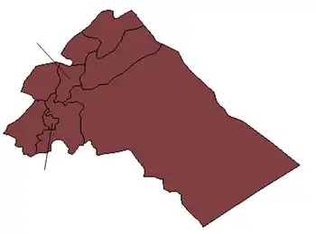
Malihah Subdistrict (Arabic: ناحية المليحة, romanized: Nāḥiyah al-Mulayḥa) is a subdistrict of Markaz Rif Dimashq District in the Rif Dimashq Governorate of Syria. The administrative centre is the town of al-Malihah. Neighbouring subdistricts are Kafr Batna to the north, Jaramana and Babbila to the west, Nashabieh and al-Ghizlaniyah to the east.
At the 2004 census, the subdistrict had a population of 56,652.[1]
The subdistrict, much like the rest of Eastern Ghouta was under rebel control, however was retaken by government forces in 2015 after the Battle of Al-Malihah.[2]
Cities, towns and villages
| PCode | Name | Population |
|---|---|---|
| C2308 | al-Malihah | 23,034 |
| C2305 | Shabaa | 13,446 |
| C2307 | Zabdin | 7,003 |
| C2309 | Deir al-Asafir | 6,209 |
| C2311 | Hutaytet al-Turkman | 4,800 |
| N/A | Sahba | 1,111 |
| C2306 | Ahdaf | 572 |
| C2310 | Hawsh al-Sultan | 477 |
References
- 1 2 "General Census of Population 2004". Retrieved 2017-10-20.
- ↑ "The siege and death in Eastern Ghota - December 2017 - Syrian Arab Republic". ReliefWeb. Retrieved 3 August 2021.
|   | ||||||||||||||||||
|
| |||||||||||||||||||
| |||||||||||||||||||
| |||||||||||||||||||
| |||||||||||||||||||
| |||||||||||||||||||
| |||||||||||||||||||
| |||||||||||||||||||
| |||||||||||||||||||
This article is issued from Wikipedia. The text is licensed under Creative Commons - Attribution - Sharealike. Additional terms may apply for the media files.