| Site of Special Scientific Interest | |
 Allt y Gaer woodland above the farm of the same name | |
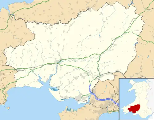
 Location within Carmarthenshire | |
| Location | Carmarthen & Dinefwr |
|---|---|
| Grid reference | SN 572 211 |
| Coordinates | 51°52′13″N 4°04′32″W / 51.870143°N 4.07556°W |
| Interest | Biological |
| Area | 3.5 hectares (8.6 acres) |
| Notification | 1980 |
Allt y Gaer (Welsh for 'hill of the fort') is a Site of Special Scientific Interest (SSSI) in Llangathen community, Carmarthenshire, Wales. It is a 3.5ha conifer woodland on the northern slopes of the Tywi Valley, which has SSSI protected designation because it holds the largest heronry in West Wales.[1]
Heronry
The Heron population of the woods gradually expanded such that by 1980 there were routinely more than 40 pairs, representing some 7-10% of the heron population of West Wales.[1] Before the growth in population at Allt y Gaer, there had been a large heronry a little way upstream at Allt y wern, and in the 19th century they are thought to have used an area of Dinefwr Park National Nature Reserve still known as 'The Heronry'.[2] Why Herons abandon one site and move to another remains unknown, but may be connected to disturbance during tree-felling operations. The SSSI designation aims to encourage as little disturbance as possible, especially during the February–June breeding season, whilst maintaining an abundance of nesting sites and food supplies.[3]
Conifer woods

The woodland is a monocultural stand of mature conifers - especially larch. Although the dense shade and extensive litter layer of needles and branches have completely suppressed the pre-plantation flora, the mature stand of trees has allowed a significant growth of various species of fungi; in particular the wood provides a habitat for Spotted Toughshank (Rhodocollybia maculata), Plums and Custard (Tricholomopsis rutilans) and Clouded Agaric (Clitocybe nebularis).[3]
Hill of the fortress
Higher up the slopes, 350 metres (1,150 ft) to the north, is an Iron Age hillfort called Grongaer[4] which gives the name to the hillside, the woodland, and a nearby farm.
See also
References
- 1 2 Natural Resources Wales, Designated sites: Allt y Gaer SSSI 0974
- ↑ Friese, Jullian, 1992, Birds of the Tywi Valley, Llanelli Naturalists Newsletter - Summer 1992, accessed 27 April 2016
- 1 2 'Your Special Site and its Future', Allt y Gaer SSSI report, Natural Resources Wales
- ↑ Grongaer (ID PRN704). in the 'SMR' for Dyfed Archaeological Trust (DAT)