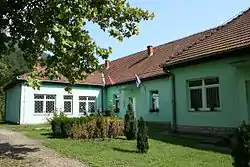
Amajić
Амајић | |
|---|---|
 | |
 Amajić Location within Serbia | |
| Coordinates: 44°19′9″N 19°8′57″E / 44.31917°N 19.14917°E | |
| Country | |
| District | Mačva |
| Municipality | Mali Zvornik |
| Population (2011)[1] | |
| • Total | 156 |
| Time zone | UTC+1 (CET) |
| • Summer (DST) | UTC+2 (CEST) |
Amajić (Serbian Cyrillic: Амајић; pronounced [amajitɕ]) is a village in west-central Serbia. It is situated in the municipality of Mali Zvornik in the Mačva District of Central Serbia. The village is located on the banks of Zvornik Lake, a reservoir of the Drina River, on the international border between Serbia and Bosnia and Herzegovina. The population was 156 at the 2011 census.
Demographics
As of the 2011 census, there were 156 people, 50 households, and 46 families in the village. There were 61 housing units, with 50 (82%) being continuously occupied. The average household size was 3.12 individuals. The average age was 42.5 years. The gender makeup was 51.2% male and 48.7% female.[2][3][4]
As of the 2002 census, there were 186 people and 57 households in the village. The average household size was 3.25 individuals. The average age was 37.5 years. The gender makeup was 48.4% male and 51.6% female. The population was majority Serb, with 184 (99%) self-declaring as ethnic Serb. Of the residents, 122 (65.6%) had lived in the village since birth, 38 (20.4%) were born elsewhere in Mali Zvornik, 16 (8.6%) were born elsewhere in Central Serbia, 2 (1.1%) were born elsewhere in the Federal Republic of Yugoslavia, 7 (3.8%) were born in other states of former Yugoslavia, and 1 (0.5%) was born in other countries.
Historical population
- 1948: 187
- 1953: 189
- 1961: 161
- 1971: 160
- 1981: 165
- 1991: 187
- 2002: 186[5]
| Year | Pop. | ±% |
|---|---|---|
| 1948 | 187 | — |
| 1953 | 189 | +1.1% |
| 1961 | 161 | −14.8% |
| 1971 | 160 | −0.6% |
| 1981 | 165 | +3.1% |
| 1991 | 187 | +13.3% |
| 2002 | 186 | −0.5% |
| 2011 | 156 | −16.1% |
| Source: [1] | ||
See also
References
- 1 2 "Comparative Overview of the Number of Population in 1948, 1953, 1961, 1971, 1981, 1991, 2002 and 2011, Data by Settlements" (PDF). stat.gov.rs. Statistical Office of the Republic of Serbia. April 2014. Retrieved 31 Jan 2021.
- ↑ "Population by Age and Sex, Data by Settlements" (PDF). stat.gov.rs. Statistical Office of the Republic of Serbia. September 2011. Retrieved 31 Jan 2021.
- ↑ "Households by Number of Members, Data by Settlements" (PDF). stat.gov.rs. Statistical Office of the Republic of Serbia. September 2011. Retrieved 31 Jan 2021.
- ↑ "Families, Data by Settlements" (PDF). stat.gov.rs. Statistical Office of the Republic of Serbia. September 2011. Retrieved 31 Jan 2021.
- ↑ in Serbian Књига 9, Становништво, упоредни преглед броја становника 1948, 1953, 1961, 1971, 1981, 1991, 2002, подаци по насељима, Републички завод за статистику, Београд, мај 2004, ISBN 86-84433-14-9
External links
44°19′09″N 19°08′57″E / 44.3192°N 19.1492°E