| American Crow Creek Tributary to Missouri River | |
|---|---|
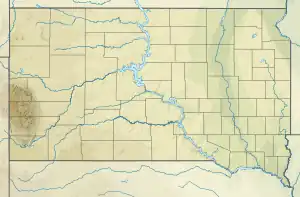
 Location of American Crow Creek mouth  American Crow Creek (the United States) | |
| Location | |
| Country | United States |
| State | South Dakota |
| County | Lyman |
| Town | Oacoma |
| Physical characteristics | |
| Source | Counselor Creek divide |
| • location | about 0.5 miles east of Medicine Butte |
| • coordinates | 43°57′56.97″N 099°36′4.39″W / 43.9658250°N 99.6012194°W[1] |
| • elevation | 2,100 ft (640 m)[1] |
| Mouth | Missouri River |
• location | Oacoma, South Dakota |
• coordinates | 43°46′56.98″N 099°24′24.77″W / 43.7824944°N 99.4068806°W[1] |
• elevation | 1,355 ft (413 m)[1] |
| Length | 26.64 mi (42.87 km)[2] |
| Basin size | 112.17 square miles (290.5 km2)[3] |
| Discharge | |
| • location | Missouri River |
| • average | 10.29 cu ft/s (0.291 m3/s) at mouth with Missouri River[3] |
| Basin features | |
| Progression | Missouri River → Mississippi River → Gulf of Mexico |
| River system | Missouri River |
| Tributaries | |
| • left | North Fork American Crow Creek |
| • right | Big Creek |
| Bridges | SD 47, 238th Street, 329th Avenue (x2), 241st Street, 242nd Street, 243rd Street, Service Road, I-90 |
American Crow Creek is a stream in the U.S. state of South Dakota.[1]
According to tradition, American Crow Creek received its name directly from Lewis and Clark.[4]
See also
References
- 1 2 3 4 5 U.S. Geological Survey Geographic Names Information System: American Crow Creek
- ↑ "ArcGIS Web Application". epa.maps.arcgis.com. US EPA. Retrieved January 11, 2023.
- 1 2 "Watershed Report | Office of Water | US EPA". watersgeo.epa.gov. US EPA. Retrieved 11 January 2023.
- ↑ Federal Writers' Project (1940). South Dakota place-names, v.3. University of South Dakota. p. 6.
This article is issued from Wikipedia. The text is licensed under Creative Commons - Attribution - Sharealike. Additional terms may apply for the media files.