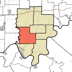
Anderson Township | |
|---|---|
 Location in Perry County | |
| Coordinates: 38°02′47″N 86°42′23″W / 38.04639°N 86.70639°W | |
| Country | |
| State | |
| County | Perry |
| Government | |
| • Type | Indiana township |
| Area | |
| • Total | 59.5 sq mi (154 km2) |
| • Land | 59.44 sq mi (153.9 km2) |
| • Water | 0.06 sq mi (0.2 km2) 0.10% |
| Elevation | 410 ft (125 m) |
| Population (2010) | |
| • Total | 1,557 |
| • Density | 26.2/sq mi (10.1/km2) |
| ZIP codes | 47515, 47520, 47577, 47586 |
| GNIS feature ID | 453088 |
Anderson Township is one of seven townships in Perry County, Indiana, United States. As of the 2010 census, its population was 1,557 and it contained 644 housing units.[1]
History
Anderson Township was named after the Anderson River.[2]
The Huffman Mill Covered Bridge was listed on the National Register of Historic Places in 1998.[3]
Geography
According to the 2010 census, the township has a total area of 59.5 square miles (154 km2), of which 59.44 square miles (153.9 km2) (or 99.90%) is land and 0.06 square miles (0.16 km2) (or 0.10%) is water.[1]
Unincorporated towns
- Gatchel at 38°02′48″N 86°39′02″W / 38.046726°N 86.650540°W
- Lilly Dale at 38°00′42″N 86°39′05″W / 38.011726°N 86.651373°W
- Ranger at 38°05′45″N 86°41′08″W / 38.095892°N 86.685542°W
(This list is based on USGS data and may include former settlements.)
Cemeteries
The township contains these thirteen cemeteries: Avery, Covey, Davis, Dodson, Frakes, Hammack, Hicks, Mackey, Niles, Nixon, Richards, Slaughter and Terry.
Major highways
Airports and landing strips
- Perry County Municipal Airport
Lakes
- Saddle Lake
School districts
- Perry Central Community School Corporation
- Tell City-Troy Township School Corporation
Political districts
- State House District 73
- State House District 74
- State Senate District 47
References
- "Anderson Township, Perry County, Indiana". Geographic Names Information System. United States Geological Survey, United States Department of the Interior. Retrieved November 21, 2009.
- United States Census Bureau 2009 TIGER/Line Shapefiles
- IndianaMap
- 1 2 "Population, Housing Units, Area, and Density: 2010 - County -- County Subdivision and Place -- 2010 Census Summary File 1". United States Census. Archived from the original on February 12, 2020. Retrieved May 10, 2013.
- ↑ Hunt, Thomas James De la (1916). Perry County: A History. W.K. Stewart. p. 18.
- ↑ "National Register Information System". National Register of Historic Places. National Park Service. July 9, 2010.