| Andys Creek Tributary to Bear Creek | |
|---|---|
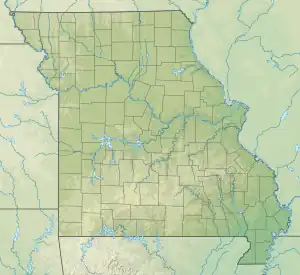
 Location of Andys Creek mouth  Andys Creek (the United States) | |
| Location | |
| Country | United States |
| State | Missouri |
| County | Wayne |
| Physical characteristics | |
| Source | McCabe Creek divide |
| • location | about 8 miles northeast of Greenville, Missouri |
| • coordinates | 37°11′2.19″N 090°17′19.40″W / 37.1839417°N 90.2887222°W[1] |
| • elevation | 575 ft (175 m)[1] |
| Mouth | Bear Creek |
• location | about 10 miles north-northeast of Childers Hill |
• coordinates | 37°10′8.19″N 090°14′39.39″W / 37.1689417°N 90.2442750°W[1] |
• elevation | 400 ft (120 m)[1] |
| Length | 2.65 mi (4.26 km)[2] |
| Basin size | 3.90 square miles (10.1 km2)[3] |
| Discharge | |
| • location | Bear Creek |
| • average | 7.65 cu ft/s (0.217 m3/s) at mouth with Bear Creek[3] |
| Basin features | |
| Progression | Bear Creek → Castor River → Headwater Diversion Channel → Mississippi River → Gulf of Mexico |
| River system | Castor River |
| Tributaries | |
| • left | unnamed tributaries |
| • right | unnamed tributaries |
| Bridges | Mo-Oo |
Andys Creek is a stream in eastern Wayne County, Missouri.[1] It is a tributary of Bear Creek.
Andys Creek, historically called "Andy's Branch", has the name of a pioneer citizen.[4]
See also
References
- 1 2 3 4 5 U.S. Geological Survey Geographic Names Information System: Andys Creek
- ↑ "ArcGIS Web Application". epa.maps.arcgis.com. US EPA. Retrieved January 11, 2023.
- 1 2 "Watershed Report | Office of Water | US EPA". watersgeo.epa.gov. US EPA. Retrieved 11 January 2023.
- ↑ "Wayne County Place Names, 1928–1945". The State Historical Society of Missouri. Archived from the original on June 24, 2016. Retrieved January 1, 2017.
This article is issued from Wikipedia. The text is licensed under Creative Commons - Attribution - Sharealike. Additional terms may apply for the media files.