Anhanguera | |
|---|---|
 | |
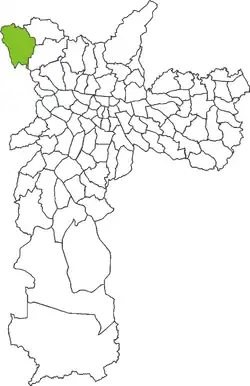 Location in the city of São Paulo | |
| Coordinates: 23°25′58.800″S 46°47′37.453″W / 23.43300000°S 46.79373694°W | |
| Country | |
| State | |
| Region | Southeast |
| City | |
| Administrative Zone | Northwest |
| Subprefecture | Perus |
| Bairros | List
|
| Area | |
| • Total | 33.44 km2 (12.91 sq mi) |
| Population (2008) | |
| • Total | 58,708 |
| • Density | 1,755.39/km2 (4,546.4/sq mi) |
Anhanguera (ⓘ) is a district within the subprefecture of Perus in São Paulo, Brazil.[1]
References
- ↑ "Subprefeitura Perus - Portal da Prefeitura da Cidade de São Paulo". Archived from the original on 19 November 2016. Retrieved 6 November 2016.

This article is issued from Wikipedia. The text is licensed under Creative Commons - Attribution - Sharealike. Additional terms may apply for the media files.