Anjalankoski | |
|---|---|
Town | |
| Anjalankosken kaupunki Anjalankoski stad | |
 Coat of arms | |
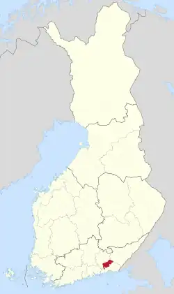
 Location of Anjalankoski in Finland | |
| Coordinates: 60°45′00″N 026°49′25″E / 60.75000°N 26.82361°E | |
| Country | |
| Region | Kymenlaakso |
| Charter | 1975 |
| City rights | 1977 |
| Area | |
| • Total | 752.92 km2 (290.70 sq mi) |
| • Land | 726.6 km2 (280.5 sq mi) |
| • Water | 26.32 km2 (10.16 sq mi) |
| Population (12/31/2008) | |
| • Total | 16 379 |
| • Density | 22.54/km2 (58.4/sq mi) |
| Time zone | UTC+02:00 (EET) |
| • Summer (DST) | UTC+03:00 (EEST) |
| Postal code | 46800 |
Anjalankoski is a former town and municipality of Finland. It had 16 379 inhabitants in 2008.[1] About 4/5 of the people live in the vicinity of the Kymi River. The most densely populated communities are Myllykoski and Inkeroinen. In addition, there is plenty of countryside.
The town's major industry is forestry along the Kymi Riverside. The paper factories Stora Enso Oyj and Myllykoski Paper Oy are the main employers together with the town itself.
Anjalankoski offered plenty of cultural and sport activities, including a football team, MyPa. The Anjala Manor Museum and surroundings is an interesting cultural site.
The municipality was unilingually Finnish.
Anjalankoski was formed in 1975 from the merging of the municipalities of Anjala and Sippola.
As of 2009, six municipalities – Kouvola, Kuusankoski, Elimäki, Anjalankoski, Valkeala and Jaala – were consolidated, accounting for the new municipality of Kouvola with a population of over 80,000, being the 10th largest city in Finland.
Near Anjalankoski (at 60° 41′ 32.34″ N, 27° 2′ 47.46″ E), there is 318 meter tall TV mast, which is one of the tallest man-made objects in Finland.
References
- ↑ "Population by municipality as of 31 December 2008". Population Information System (in Finnish and Swedish). Population Register Center of Finland. Archived from the original on 2011-07-20. Retrieved 23 November 2010.
External links
![]() Media related to Anjalankoski at Wikimedia Commons
Media related to Anjalankoski at Wikimedia Commons
