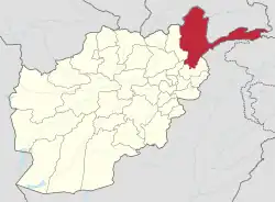
The Anjuman Pass (Persian: كتل انجمن Kotal-e Anjoman) (also written Anjoman Pass) (4,430 m) is a mountain pass in the Hindu Kush in Afghanistan. It connects the Panjshir Valley and beyond in the south-west with Badakhshan province and beyond to the north-east, which is the most north-easterly province of Afghanistan.[1][2][3] The Anjuman Pass is located on Panjshir Province's border with Badakhshan and Takhar province. The climate in this area is usually cold with snow. The roads are narrow and slippery.[1]
References
- 1 2 "Kotal-e Anjoman". www.dangerousroads.org. Retrieved 2020-08-19.
- ↑ "Anjuman Pass (Anjumanpass) Map, Weather and Photos - Afghanistan: pass - Lat:35.9508 and Long:70.4078". www.getamap.net. Retrieved 2020-08-20.
- ↑ "Five Years Later Afghanistan Faces New Threats From an Old Foe". Nieman Reports. Retrieved 2020-08-22.
External links
36°.95942′N 70°.41119′E / 36.01599033°N 70.00685317°E
This article is issued from Wikipedia. The text is licensed under Creative Commons - Attribution - Sharealike. Additional terms may apply for the media files.

