| Apikuni Mountain | |
|---|---|
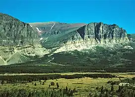 South aspect | |
| Highest point | |
| Elevation | 9,073 ft (2,765 m)[1] |
| Prominence | 1,468 ft (447 m)[1] |
| Parent peak | Gable Mountain[1] |
| Listing | Mountains in Glacier County, Montana |
| Coordinates | 48°50′11″N 113°39′14″W / 48.83639°N 113.65389°W[2] |
| Geography | |
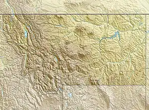 Apikuni Mountain Location in Montana  Apikuni Mountain Location in the United States | |
| Location | Glacier County, Montana, U.S. |
| Parent range | Lewis Range |
| Topo map | USGS Many Glacier MT |
Apikuni Mountain (9,073 feet (2,765 m)) is located in the Lewis Range, Glacier National Park in the U.S. state of Montana.[1][3]
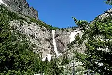
Apikuni Falls
See also
References
- 1 2 3 4 "Apikuni Mountain, Montana". Peakbagger.com. Retrieved May 30, 2018.
- ↑ "Apikuni Mountain". Geographic Names Information System. United States Geological Survey, United States Department of the Interior. Retrieved May 30, 2018.
- ↑ Many Glacier, MT (Map). TopoQwest (United States Geological Survey Maps). Retrieved May 30, 2018.

Apikuni Mountain in 1954
This article is issued from Wikipedia. The text is licensed under Creative Commons - Attribution - Sharealike. Additional terms may apply for the media files.