Arandun | |
|---|---|
Town | |
 Arandun | |
| Coordinates: 08°05′42″N 04°56′35″E / 8.09500°N 4.94306°E | |
| Country | |
| State | Kwara |
| LGA | Irepodun |
| Area | |
| • Total | 1.23 km2 (0.47 sq mi) |
| Elevation | 467 m (1,532 ft) |
| Time zone | UTC+1 (WAT) |
| Postal code | 251101 |
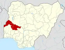
Arandun is a town in Irepodun LGA, Kwara State, Nigeria. It is located near the state boundary with Osun, about 66 kilometres southeast of the state capital Ilorin, and 18 kilometres southwest of the area capital Omu-Aran.[1]
Geography
Arandun is located along the Oro-Omu Ipetu Road, on the east of Omugo, south of Odun, west of Irore, and north of Ila. Its average elevation is at 467 metres above the sea level.[2]
Climate
Arandun has a Tropical Savanna Climate according to the Köppen Climate Classification. Its wettest month is September, with an average rainfall of 282 mm; and the driest month is December, with an average rainfall of 7 mm.
| Climate data for Arandun | |||||||||||||
|---|---|---|---|---|---|---|---|---|---|---|---|---|---|
| Month | Jan | Feb | Mar | Apr | May | Jun | Jul | Aug | Sep | Oct | Nov | Dec | Year |
| Mean daily maximum °C (°F) | 33.7 (92.7) |
34.6 (94.3) |
34.4 (93.9) |
32.6 (90.7) |
30.6 (87.1) |
28.7 (83.7) |
27.5 (81.5) |
27.1 (80.8) |
28.1 (82.6) |
29.6 (85.3) |
31.9 (89.4) |
33.3 (91.9) |
31.0 (87.8) |
| Daily mean °C (°F) | 26.4 (79.5) |
27.4 (81.3) |
27.4 (81.3) |
26.4 (79.5) |
25.3 (77.5) |
24.1 (75.4) |
23.2 (73.8) |
23 (73) |
23.4 (74.1) |
24.2 (75.6) |
25.8 (78.4) |
26.2 (79.2) |
25.2 (77.4) |
| Mean daily minimum °C (°F) | 20.7 (69.3) |
22.2 (72.0) |
23.1 (73.6) |
23.1 (73.6) |
22.6 (72.7) |
21.7 (71.1) |
21.1 (70.0) |
20.8 (69.4) |
21.1 (70.0) |
21.5 (70.7) |
22 (72) |
20.8 (69.4) |
21.7 (71.1) |
| Average rainfall mm (inches) | 10 (0.4) |
22 (0.9) |
63 (2.5) |
117 (4.6) |
193 (7.6) |
227 (8.9) |
231 (9.1) |
238 (9.4) |
282 (11.1) |
215 (8.5) |
29 (1.1) |
7 (0.3) |
1,634 (64.4) |
| Source: Climate-Data.org[3] | |||||||||||||
References
- ↑ "Arandun | Ilorin.Info | Ilorin, Kwara State". www.ilorin.info. Retrieved 2023-06-23.
- ↑ "Arandun topographic map, elevation, terrain". Topographic maps. Retrieved 2023-04-08.
- ↑ "Arandun climate: Temperature Arandun & Weather By Month - Climate-Data.org". en.climate-data.org. Retrieved 2023-04-07.
This article is issued from Wikipedia. The text is licensed under Creative Commons - Attribution - Sharealike. Additional terms may apply for the media files.
