| Astore Valley | |
|---|---|
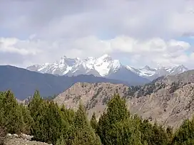
 Photograph of an unnamed, 5400-metre peak raising jagged, snow-clad ramparts above the Astore Valley | |
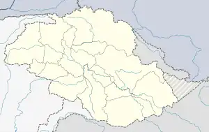
 Astore Valley Location within Astore District  Astore Valley Location in Pakistan | |
| Floor elevation | 2,600 m (8,500 ft) |
| Length | 120 km (75 mi) |
| Naming | |
| Native name | وادی استور (Urdu) |
| Geography | |
| Coordinates | 35°02′20.3″N 75°06′36.9″E / 35.038972°N 75.110250°E |
The Astore Valley (Urdu: وادی استور; el. 2,600 m (8,500 ft)) is a valley located in the Astore District of Gilgit-Baltistan, Pakistan.[1]
History
According to The Imperial Gazetteer of India, around 1600:
Ghāzī Mukhpun, a Persian adventurer, is said to have married a princess of the Skārdu reigning family. The four sons born of this union became Rās of Skārdu, Astor, Roundu, and Kharmang respectively, and from them are descended the families of the present chiefs of those places. The independence of Astor ceased at the Dogra conquest.[2]
See also
References
- ↑ Muhammad, Sher; Tian, Lide (15 December 2016). "Changes in the ablation zones of glaciers in the western Himalaya and the Karakoram between 1972 and 2015". Remote Sensing of Environment. 187: 505–512. Bibcode:2016RSEnv.187..505M. doi:10.1016/j.rse.2016.10.034. ISSN 0034-4257.
- ↑ Gilgit - Imperial Gazetteer of India, v. 12, p. 239 According to the Imperial Gazetteer, which was compiled in the first decade of the twentieth century, the marriage took place over three hundred years ago
This article is issued from Wikipedia. The text is licensed under Creative Commons - Attribution - Sharealike. Additional terms may apply for the media files.