| Ayan-Yuryakh | |
|---|---|
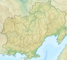
 The Ayan-Yuryakh is located near the southwest corner of the Kolyma river basin | |
 Mouth location in Magadan Oblast, Russia | |
| Native name | Аян-Юрях (Russian) |
| Physical characteristics | |
| Source | Khalkan Range |
| • location | Susumansky District, Magadan Oblast, Russia |
| • coordinates | 62°55′N 146°08′E / 62.91°N 146.13°E |
| • elevation | 992 metres (3,255 ft)[1] |
| Mouth | Kolyma river |
• location | Tenkinsky District, Magadan Oblast, Russia |
• coordinates | 62°17′40″N 147°43′55″E / 62.29444°N 147.73194°E |
• elevation | 519 metres (1,703 ft) |
| Length | 237 kilometres (147 mi)[2] |
| Basin size | 24,100 square kilometres (9,300 sq mi)[2] |
| Basin features | |
| Progression | Kolyma→ East Siberian Sea |
The Ayan-Yuryakh is a river in the Magadan Oblast of Russia. It is a left tributary of the Kolyma river, which forms at the confluence of the Ayan-Yuryakh and the Kulu.[1]
Course
The source of the river is in the Khalkan Range. The river flows across the Upper Kolyma Highlands and is fed primarily by rain and snow.[3]
Its main tributary is the 239 km (149 mi) long Byoryolyokh from the right.[2]
See also
References
- 1 2 "Аян-Юрях" [Ayan-Yuryakh]. Вода Россия [Water Russia] (in Russian). Retrieved 10 July 2021.
- 1 2 3 "Река Аян-Юрях" [Ayan-Yuryakh River]. Государственный Водный Реестр [State Water Register] (in Russian). Retrieved 10 July 2021.
- ↑ "Аян-Юрях". Больша́я сове́тская энциклопе́дия (in Russian). Retrieved 10 July 2021.
This article is issued from Wikipedia. The text is licensed under Creative Commons - Attribution - Sharealike. Additional terms may apply for the media files.