Baldwin City, Kansas | |
|---|---|
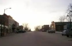 Downtown Baldwin City (2008) | |
 Flag | |
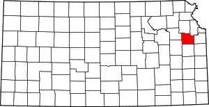
 Location within Douglas County and Kansas | |
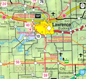 KDOT map of Douglas County (legend) | |
| Coordinates: 38°46′41″N 95°11′17″W / 38.77806°N 95.18806°W[1] | |
| Country | United States |
| State | Kansas |
| County | Douglas |
| Founded | 1850s |
| Incorporated | 1870 |
| Named for | John Baldwin |
| Area | |
| • Total | 2.69 sq mi (6.96 km2) |
| • Land | 2.67 sq mi (6.92 km2) |
| • Water | 0.02 sq mi (0.04 km2) |
| Elevation | 1,066 ft (325 m) |
| Population | |
| • Total | 4,826 |
| • Density | 1,800/sq mi (690/km2) |
| Time zone | UTC-6 (CST) |
| • Summer (DST) | UTC-5 (CDT) |
| ZIP code | 66006 |
| Area code | 785 |
| FIPS code | 20-03900 |
| GNIS ID | 2394055[1] |
| Website | baldwincity.org |
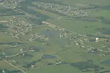
Baldwin City is a city in Douglas County, Kansas, United States,[1] about 12 miles (19 km) south of Lawrence. As of the 2020 census, the population of the city was 4,826.[3] The city is home to Baker University, the state's oldest four-year university.
History

Early history
Baldwin City began as a trail stop on the Santa Fe Trail named Palmyra. The small community consisted of a harness shop, blacksmith, hotel, lawyer, drug store, two doctors and a tavern. In 1858, a group of Methodist ministers gathered at Kibbee Cabin and founded Baker University. Palmyra bought land to the south for the university and surrounding city. The first post office was established in June, 1857.[4]
A main benefactor of the community was John Baldwin and the town was named in his honor.[5] Baldwin built a saw mill which was at present-day Fifth and Indiana Streets. Baldwin City was incorporated on September 22, 1870.
Baldwin City unwittingly found themselves surrounded by the events that led up to the American Civil War. Three miles east of Baldwin was the town site of Black Jack where the Battle of Black Jack took place on June 2, 1856. The night before that battle, John Brown stayed in Prairie City. In 1863, Quantrill's raiders passed within three miles (5 km) of Baldwin after the burning of Lawrence.
Midland Railway
In 1867, the Leavenworth, Lawrence and Galveston Railroad laid tracks and became the first Kansas railroad south of the Kansas River. In 1906, the Santa Fe Depot was built and today the Midland Railway offers over 20-mile round trip excursion rides to Ottawa via "Nowhere" and Norwood. Midland's Scout program is one of the few in the country to offer a railroading merit badge and Midland has hosted a Thomas the Tank Engine attraction the last few years.[6]
Maple Leaf Festival
Every year since 1957, Baldwin City has hosted the Maple Leaf Festival during the third full weekend in October. It began as a way to celebrate a successful harvest and to view the fall foliage. Today, it is the largest fall family event in the area and features a parade, arts and crafts, quilt show, theatrical performances, history tours, train rides and live music. Annually it draws crowds of 30,000 or more.
Geography
According to the United States Census Bureau, the city has an area of 2.64 square miles (6.84 km2), of which 2.62 square miles (6.79 km2) is land and 0.02 square miles (0.05 km2) is water.[7]
Climate
The area's climate is characterized by hot, humid summers and generally cool to cold winters. According to the Köppen Climate Classification system, Baldwin City has a humid subtropical climate, abbreviated "Cfa" on climate maps.[8]
Demographics
| Census | Pop. | Note | %± |
|---|---|---|---|
| 1880 | 325 | — | |
| 1890 | 935 | 187.7% | |
| 1900 | 1,017 | 8.8% | |
| 1910 | 1,386 | 36.3% | |
| 1920 | 1,137 | −18.0% | |
| 1930 | 1,127 | −0.9% | |
| 1940 | 1,096 | −2.8% | |
| 1950 | 1,741 | 58.9% | |
| 1960 | 1,877 | 7.8% | |
| 1970 | 2,520 | 34.3% | |
| 1980 | 2,829 | 12.3% | |
| 1990 | 2,961 | 4.7% | |
| 2000 | 3,400 | 14.8% | |
| 2010 | 4,515 | 32.8% | |
| 2020 | 4,826 | 6.9% | |
| U.S. Decennial Census | |||
Baldwin City is part of the Lawrence Metropolitan Statistical Area.
2020 census
The 2020 United States census counted 4,826 people, 1,651 households, and 1,085 families in Baldwin City.[9][10] The population density was 1,802.8 per square mile (696.0/km2). There were 1,748 housing units at an average density of 653.0 per square mile (252.1/km2).[10][11] The racial makeup was 87.65% (4,230) white or European American (85.81% non-Hispanic white), 1.99% (96) black or African-American, 0.97% (47) Native American or Alaska Native, 0.73% (35) Asian, 0.12% (6) Pacific Islander or Native Hawaiian, 1.64% (79) from other races, and 6.9% (333) from two or more races.[12] Hispanic or Latino of any race was 4.33% (209) of the population.[13]
Of the 1,651 households, 34.5% had children under the age of 18; 48.6% were married couples living together; 25.9% had a female householder with no spouse or partner present. 28.7% of households consisted of individuals and 14.4% had someone living alone who was 65 years of age or older.[10] The average household size was 2.7 and the average family size was 3.2.[14] The percent of those with a bachelor’s degree or higher was estimated to be 23.5% of the population.[15]
22.2% of the population was under the age of 18, 20.7% from 18 to 24, 20.0% from 25 to 44, 21.2% from 45 to 64, and 15.9% who were 65 years of age or older. The median age was 31.5 years. For every 100 females, there were 104.1 males.[10] For every 100 females ages 18 and older, there were 106.8 males.[10]
The 2016-2020 5-year American Community Survey estimates show that the median household income was $74,074 (with a margin of error of +/- $7,962) and the median family income was $76,346 (+/- $17,265).[16] Males had a median income of $34,583 (+/- $20,308) versus $16,000 (+/- $10,190) for females. The median income for those above 16 years old was $23,188 (+/- $12,766).[17] Approximately, 4.4% of families and 7.9% of the population were below the poverty line, including 10.8% of those under the age of 18 and 6.2% of those ages 65 or over.[18][19]
2010 census
As of the census[20] of 2010, there were 4,515 people, 1,501 households, and 1,011 families living in the city. The population density was 1,723.3 inhabitants per square mile (665.4/km2). There were 1,665 housing units at an average density of 635.5 per square mile (245.4/km2). The racial makeup of the city was 93.4% White, 2.1% African American, 0.7% Native American, 0.5% Asian, 0.6% from other races, and 2.7% from two or more races. Hispanic or Latino of any race were 3.0% of the population.
There were 1,501 households, of which 37.5% had children under the age of 18 living with them, 52.6% were married couples living together, 10.2% had a female householder with no husband present, 4.5% had a male householder with no wife present, and 32.6% were non-families. 26.8% of all households were made up of individuals, and 12.1% had someone living alone who was 65 years of age or older. The average household size was 2.54 and the average family size was 3.08.
The median age in the city was 30.2 years. 24.3% of residents were under the age of 18; 20.9% were between the ages of 18 and 24; 22.9% were from 25 to 44; 20.1% were from 45 to 64; and 11.9% were 65 years of age or older. The gender makeup of the city was 48.5% male and 51.5% female.
2000 census
As of the census of 2000, there were 3,400 people, 1,077 households, and 774 families living in the city. The population density was 1,565.1 inhabitants per square mile (604.3/km2). There were 1,165 housing units at an average density of 536.3 per square mile (207.1/km2). The racial makeup of the city was 93.62% White, 1.12% African American, 0.74% Native American, 0.62% Asian, 0.06% Pacific Islander, 0.38% from other races, and 3.47% from two or more races. Hispanic or Latino of any race were 1.62% of the population.
There were 1,077 households, out of which 39.6% had children under the age of 18 living with them, 57.8% were married couples living together, 10.4% had a female householder with no husband present, and 28.1% were non-families. 24.8% of all households were made up of individuals, and 10.0% had someone living alone who was 65 years of age or older. The average household size was 2.59 and the average family size was 3.10.
In the city, the population was spread out, with 25.3% under the age of 18, 21.8% from 18 to 24, 24.2% from 25 to 44, 17.4% from 45 to 64, and 11.2% who were 65 years of age or older. The median age was 28 years. For every 100 females, there were 97.7 males. For every 100 females age 18 and over, there were 90.5 males.
The median income for a household in the city was $43,269, and the median income for a family was $51,667. Males had a median income of $37,111 versus $25,850 for females. The per capita income for the city was $16,698. About 5.6% of families and 7.6% of the population were below the poverty line, including 11.0% of those under age 18 and 5.7% of those age 65 or over.
Government
The Baldwin City government consists of a mayor and five council members. The council meets the first and third Tuesdays of each month at 7:00pm.[21]
- City Hall, 803 Eighth Street.
Education
Primary and secondary education
The community is served by Baldwin City USD 348 public school district, and serves most of southern Douglas County. It maintains four schools in Baldwin City (Baldwin Elementary, Baldwin Intermediate, Baldwin Junior High and Baldwin High School). On December 13, 2010, the USD 348 Board of Education voted to close the schools in Vinland and Worden at the end of the 2010–2011 school year.[22]
- Baldwin High School is home to the Bulldogs.[23]
College
Baldwin City is home to the main campus of Baker University, a liberal arts university founded in 1858 by United Methodist ministers. It is the oldest four-year university in Kansas and has been coed since it was founded.
Notable people
Gallery
 To the right of the sign are remnants of wagon ruts left from the Santa Fe Trail in the Ivan Boyd Prairie Preserve near Baldwin City. Also was the site of Black Jack.
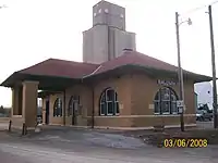 The Santa Fe Depot for the Midland Railway in west Baldwin City.
See also
References
- 1 2 3 4 U.S. Geological Survey Geographic Names Information System: Baldwin City, Kansas
- ↑ "2019 U.S. Gazetteer Files". United States Census Bureau. Retrieved July 24, 2020.
- 1 2 "Profile of Baldwin City, Kansas in 2020". United States Census Bureau. Archived from the original on December 20, 2022. Retrieved December 20, 2022.
- ↑ "Kansas Post Offices, 1828-1961 (archived)". Kansas Historical Society. Archived from the original on March 10, 2013. Retrieved June 8, 2014.
- ↑ Kansas State Historical Society (1916). Biennial Report of the Board of Directors of the Kansas State Historical Society. Kansas State Printing Plant. pp. 181.
- ↑ "Historical Excursion Train - Midland Railway Historical Association". www.midlandrailway.org. Retrieved April 22, 2018.
- ↑ "US Gazetteer files 2010". United States Census Bureau. Archived from the original on January 25, 2012. Retrieved July 6, 2012.
- ↑ "Baldwin City, Kansas Köppen Climate Classification (Weatherbase)". Weatherbase. Retrieved April 22, 2018.
- ↑ "US Census Bureau, Table P16: HOUSEHOLD TYPE". data.census.gov. Retrieved December 31, 2023.
- 1 2 3 4 5 "US Census Bureau, Table DP1: PROFILE OF GENERAL POPULATION AND HOUSING CHARACTERISTICS". data.census.gov. Retrieved December 31, 2023.
- ↑ Bureau, US Census. "Gazetteer Files". Census.gov. Retrieved December 30, 2023.
- ↑ "US Census Bureau, Table P1: RACE". data.census.gov. Retrieved December 31, 2023.
- ↑ "US Census Bureau, Table P2: HISPANIC OR LATINO, AND NOT HISPANIC OR LATINO BY RACE". data.census.gov. Retrieved December 31, 2023.
- ↑ "US Census Bureau, Table S1101: HOUSEHOLDS AND FAMILIES". data.census.gov. Retrieved December 31, 2023.
- ↑ "US Census Bureau, Table S1501: EDUCATIONAL ATTAINMENT". data.census.gov. Retrieved December 31, 2023.
- ↑ "US Census Bureau, Table S1903: MEDIAN INCOME IN THE PAST 12 MONTHS (IN 2020 INFLATION-ADJUSTED DOLLARS)". data.census.gov. Retrieved December 31, 2023.
- ↑ "US Census Bureau, Table S2001: EARNINGS IN THE PAST 12 MONTHS (IN 2020 INFLATION-ADJUSTED DOLLARS)". data.census.gov. Retrieved December 31, 2023.
- ↑ "US Census Bureau, Table S1701: POVERTY STATUS IN THE PAST 12 MONTHS". data.census.gov. Retrieved December 31, 2023.
- ↑ "US Census Bureau, Table S1702: POVERTY STATUS IN THE PAST 12 MONTHS OF FAMILIES". data.census.gov. Retrieved December 31, 2023.
- ↑ "U.S. Census website". United States Census Bureau. Retrieved July 6, 2012.
- ↑ City Council baldwincity.gov
- ↑ Gillispie, Jimmy (December 13, 2010). "School board closes rural elementary schools by 5-2 vote". Baldwin City Signal. Archived from the original on May 14, 2012. Retrieved December 14, 2010.
- ↑ Hirschmann, Makayla (December 3, 2020). "Bulldog fall sports overcome adversities for successful season". Bulldog Bulletin Online. Archived from the original on December 3, 2020.
Further reading
- A Self-Guided Tour of Baldwin City's Historic Sites on the Santa Fe Trail by Loren K. Litteer
- The Leavenworth, Lawrence & Ft. Gibson Railroad by Loren K. Litteer
External links
- City
- Schools
- USD 348, local school district
- Historical
- Local Media
- Maps
- Baldwin city map, KDOT
