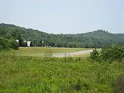
Bancroft Airport | |||||||||||
|---|---|---|---|---|---|---|---|---|---|---|---|
 | |||||||||||
| Summary | |||||||||||
| Airport type | Public | ||||||||||
| Operator | Bancroft Flying Club | ||||||||||
| Location | Bancroft, Ontario | ||||||||||
| Time zone | EST (UTC−05:00) | ||||||||||
| • Summer (DST) | EDT (UTC−04:00) | ||||||||||
| Elevation AMSL | 1,085 ft / 331 m | ||||||||||
| Coordinates | 45°04′23″N 077°52′50″W / 45.07306°N 77.88056°W | ||||||||||
| Map | |||||||||||
 CNW3 Location in Ontario | |||||||||||
| Runways | |||||||||||
| |||||||||||
Source: Canada Flight Supplement[1] | |||||||||||
Bancroft Airport (TC LID: CNW3) is adjacent to Bancroft, Ontario, Canada.
The airport is operated by the Bancroft Flying Club and is freely available to the general public. Due to high terrain near both ends of the runway, pilots typically use a non-standard circuit, following the York River valley through the town for departing from runway 12 or landing on runway 30.
References
This article is issued from Wikipedia. The text is licensed under Creative Commons - Attribution - Sharealike. Additional terms may apply for the media files.