| Baraga State Park | |
|---|---|
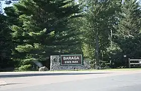
 Entrance sign | |
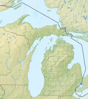
 Location in Michigan  Baraga State Park (the United States) | |
| Location | Baraga Township, Baraga County, Michigan |
| Nearest city | Baraga, Michigan |
| Coordinates | 46°45′54″N 88°30′03″W / 46.76500°N 88.50083°W[2] |
| Area | 56 acres (22.7 ha) |
| Elevation | 614 feet (187 m) [2] |
| Designation | Michigan State Park |
| Established | 1922 [3] |
| Administrator | Michigan Department of Natural Resources |
| Website | Baraga State Park |
Baraga State Park is a public recreation area covering 56 acres (23 ha) on the shore of Lake Superior's Keweenaw Bay in Baraga County, Michigan. The state park sits along Route 41 on the south side of the village of Baraga. The park, village, and county bear the name of Bishop Frederic Baraga.[4]
Activities and amenities
The park offers swimming, fishing, paddling, picnicking facilities, camping, nature trail, ungroomed cross-country skiing, snowmobiling, playground, and metal detecting.[4]
References
- ↑ "Baraga State Park". Protected Planet. IUCN. Retrieved March 26, 2020.
- 1 2 "Baraga State Park". Geographic Names Information System. United States Geological Survey, United States Department of the Interior.
- ↑ "When were Michigan state parks and recreation areas established?" (PDF). Michigan Department of Natural Resources. Retrieved March 26, 2020.
- 1 2 "Baraga State Park". Michigan Department of Natural Resources. Retrieved September 16, 2011.
External links
- Baraga State Park Michigan Department of Natural Resources
- Baraga State Park Map Michigan Department of Natural Resources
This article is issued from Wikipedia. The text is licensed under Creative Commons - Attribution - Sharealike. Additional terms may apply for the media files.