| Baralia River | |
|---|---|
 | |
  | |
| Native name | বৰলীয়া নদী (Assamese) |
| Location | |
| State | Assam |
| District | Tamulpur Nalbari |
| Sub-district | Rangia |
| Cities | Rangia |
| Physical characteristics | |
| Source | Lokhaitora River |
| • location | Bornadi Wildlife Sanctuary |
| • coordinates | 26°43′26.9″N 91°41′08.4″E / 26.724139°N 91.685667°E |
| Mouth | Puthimari River |
• coordinates | 26°15′29.6″N 91°27′57″E / 26.258222°N 91.46583°E |
| Basin features | |
| Progression | Lokhaitora River - Baralia River - Puthimari River - Brahmaputra River |
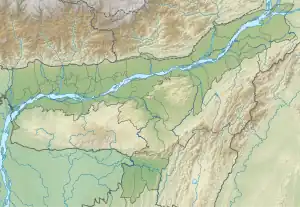
The Baralia River is a sub-tributary of the Brahmaputra River in the Indian state of Assam. The Baralia river originates in the Lokhaitora River and flows through Rangia City, Nalbari district and Tamulpur district before its confluence with the Puthimari River and the Brahmaputra river.[1][2] The Nona River is a tributary of the Baralia river.[3]
References
- ↑ "Nalbari District Embankment System". Nalbari District Website - Government of India. Archived from the original on 2021-04-20. Retrieved 2020-08-19.
- ↑ "A Study on Bank Erosion by the River Baralia" (PDF). S2CID 9505138. Archived from the original (PDF) on 2019-02-23.
- ↑ "A fluvio geomorphic study of the nona baralia river basin in Assam". hdl:10603/127573.
This article is issued from Wikipedia. The text is licensed under Creative Commons - Attribution - Sharealike. Additional terms may apply for the media files.