Barito Kuala Regency (Kabupaten Barito Kuala) | |
|---|---|
 Seal | |
| Motto: Selidah | |
 | |
| Country | Indonesia |
| Province | South Kalimantan |
| Capital | Marabahan |
| Area | |
| • Total | 2,996.46 km2 (1,156.94 sq mi) |
| Population (mid 2022 estimate) | |
| • Total | 321,769 |
| • Density | 110/km2 (280/sq mi) |
| [1] | |
| Time zone | UTC+8 (WITA) |
| Area code | +62 511 |
| Website | baritokualakab.go.id |
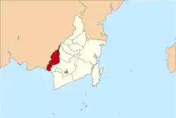
Barito Kuala Regency is one of the regencies (kabupaten) in the Indonesian province of South Kalimantan, situated in the southwest of the province. The area is 2,996.46 km2, and the population was 276,147 at the 2010 Census[2] and 313,021 at the 2020 Census;[3] the latest official estimate (as at mid 2022) was 321,769 (comprising 162,909 males and 158,860 females).[1] The capital is the town of Marabahan. The Motto of the Regency is "Selidah".
Administrative Districts
The Regency is divided into seventeen districts (Indonesian: kecamatan), tabulated below with their areas and population totals from the 2010 Census[2] and 2120 Census,[3] together with the official estimates for mid 2022.[1] The twelve most southern of the districts lie within the official Banjarmasin metropolitan area. The table also includes the locations of the district administrative centres, the number of administrative villages in each district (a total of 195 rural desa and 6 urban kelurahan), and its postal codes.
| Kode Wilayah | Name of District (kecamatan) | Area in km2 | Pop'n Census 2010 | Pop'n Census 2020 | Pop'n Estimate mid 2022 | Admin centre | No. of villages | Post codes |
|---|---|---|---|---|---|---|---|---|
| 63.04.01 | Tabunganen (a) | 240.00 | 19,143 | 20,045 | 20,283 | Tabunganen Kecil | 14 | 70567 |
| 63.04.02 | Tamban | 164.30 | 31,115 | 31,967 | 32,228 | Purwosari I | 16 | 70566 |
| 63.04.13 | Mekarsari | 143.50 | 16,312 | 17,797 | 18,152 | Tamban Raya | 9 | 70568 |
| 63.04.03 | Anjir Pasar | 126.00 | 15,456 | 17,013 | 17,397 | Anjir Pasar Kota I | 15 | 70565 |
| 63.04.04 | Anjir Muara | 116.75 | 19,456 | 21,918 | 22,494 | Anjir Muara Kota | 15 | 70564 |
| 63.04.05 | Alalak | 107.35 | 51,403 | 62,833 | 65,512 | Handil Bakti | 18 (b) | 70582 |
| 63.04.06 | Mandastana | 136.00 | 14,012 | 17,497 | 18,319 | Puntik Luar | 14 | 70580 |
| 63.04.17 | Jejangkit | 80.25 | 6,047 | 6,606 | 6,740 | Jejangkit Pasar | 7 | 70581 |
| 63.04.08 | Belawang | 37.50 | 12,717 | 13,627 | 13,851 | Belawang | 13 | 70563 |
| 63.04.16 | Wanaraya | 183.00 | 12,407 | 14,342 | 14,793 | Kolam Kiri | 13 | 70560 |
| 63.04.14 | Barambai | 261.81 | 13,971 | 15,672 | 16,071 | Barambai | 11 | 70562 |
| 63.04.07 | Rantau Badauh | 206.00 | 14,132 | 16,464 | 17,007 | Sungai Gampa | 9 | 70561 |
| 63.04.09 | Cerbon | 261.00 | 8,403 | 9,969 | 10,334 | Bantuil | 8 | 70571 |
| 63.04.10 | Bakumpai | 221.00 | 9,321 | 10,537 | 10,821 | Lepasan | 9 (c) | 70512 & 70513 |
| 63.04.15 | Marabahan | 166.00 | 18,907 | 21,915 | 22,616 | Marabahan Kota | 10 (d) | 70511 - 70513 |
| 63.04.12 | Tabukan | 343.50 | 8,097 | 9,030 | 9,249 | Teluk Tamba | 11 | 70553 |
| 63.04.11 | Kuripan | 203.00 | 5,316 | 5,789 | 5,902 | Rimbun Tulang | 9 | 70552 |
| Totals | 2,996.46 | 276,147 | 313,021 | 321,769 | Marabahan Kota | 201 |
Note: (a) including 3 small offshore or riverine islands. (b) including 3 kelurahan - Berangas, Berangas Barat and Handil Bakti.
(c) including one kelurahan - Lepasan. (d) including 2 kelurahan - Marabahan Kota and Ulu Benteng.
Climate
Marabahan, the seat of the regency, has a tropical rainforest climate (Af) with heavy rainfall from October to May and moderate rainfall from June to September.
| Climate data for Marabahan | |||||||||||||
|---|---|---|---|---|---|---|---|---|---|---|---|---|---|
| Month | Jan | Feb | Mar | Apr | May | Jun | Jul | Aug | Sep | Oct | Nov | Dec | Year |
| Mean daily maximum °C (°F) | 29.6 (85.3) |
30.2 (86.4) |
30.5 (86.9) |
31.2 (88.2) |
31.2 (88.2) |
30.9 (87.6) |
31.2 (88.2) |
31.9 (89.4) |
32.3 (90.1) |
32.2 (90.0) |
31.2 (88.2) |
30.3 (86.5) |
31.1 (87.9) |
| Daily mean °C (°F) | 26.0 (78.8) |
26.5 (79.7) |
26.7 (80.1) |
27.1 (80.8) |
27.1 (80.8) |
26.6 (79.9) |
26.6 (79.9) |
26.9 (80.4) |
27.3 (81.1) |
27.3 (81.1) |
27.0 (80.6) |
26.6 (79.9) |
26.8 (80.3) |
| Mean daily minimum °C (°F) | 22.5 (72.5) |
22.8 (73.0) |
22.9 (73.2) |
23.1 (73.6) |
23.1 (73.6) |
22.3 (72.1) |
22.0 (71.6) |
22.0 (71.6) |
22.3 (72.1) |
22.5 (72.5) |
22.8 (73.0) |
22.9 (73.2) |
22.6 (72.7) |
| Average rainfall mm (inches) | 324 (12.8) |
304 (12.0) |
302 (11.9) |
228 (9.0) |
193 (7.6) |
124 (4.9) |
105 (4.1) |
100 (3.9) |
111 (4.4) |
142 (5.6) |
227 (8.9) |
299 (11.8) |
2,459 (96.9) |
| Source: Climate-Data.org[4] | |||||||||||||
References
External links
Regencies and cities of South Kalimantan | ||
|---|---|---|
Capital: Banjarbaru | ||
| Regencies | ||
| Cities | ||
3°05′00″S 114°37′00″E / 3.0833°S 114.6167°E