Beardsley, Arizona | |
|---|---|
Populated place | |
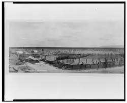 Photo of Beardsley’s Sheep pens in 1908. | |
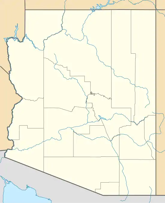 Beardsley Location of Beardsley in Arizona | |
| Coordinates: 33°39′41″N 112°22′45″W / 33.66139°N 112.37917°W | |
| Country | United States |
| State | Arizona |
| County | Maricopa |
| Elevation | 1,263 ft (385 m) |
| Time zone | UTC-7 (Mountain (MST)) |
| • Summer (DST) | UTC-7 (MST) |
| Area code | 602 |
| FIPS code | 04-05420 |
| GNIS feature ID | 1154 |
Beardsley is a populated place situated within the Sun City West CDP in Maricopa County, Arizona, United States.[2] It has an estimated elevation of 1,263 feet (385 m) above sea level, and was named for William H. Beardsley, an irrigation pioneer[3] who began an irrigation project at this location in 1888.[1]
History
The town began in 1880 around a railroad station.[4] Much of town was bulldozed in the 1940s to make way for the railroad.[5] For years it served as a sheep shearing point on the Santa Fe, Prescott & Phoenix Railroad.[4]
Beardsley's population was 12 in the 1960 census.[6]
References
- 1 2 "Feature Detail Report for: Beardsley". Geographic Names Information System. United States Geological Survey, United States Department of the Interior.
- ↑ "Beardsley (in Maricopa County, AZ) Populated Place Profile". AZ Hometown Locator. Archived from the original on April 27, 2016. Retrieved April 18, 2016.
- ↑ "Arizona Water Pioneers - William Beardsley". waterwisewisdom.com. Retrieved 2022-09-15.
- 1 2 Bercu, William M. "Beardsley Arizona". saltriverstories.org. Retrieved 2022-09-15.
- ↑ "Beardsley". ghosttowns.com. Retrieved 2022-09-15.
- ↑ "Arizona". World Book Encyclopedia. Vol. A. Chicago: Field Enterprises Educational Corporation. 1960. p. 557.
Municipalities and communities of Maricopa County, Arizona, United States | ||
|---|---|---|
| Cities |  | |
| Towns | ||
| CDPs | ||
| Populated places |
| |
| Indian reservations | ||
| Ghost towns/ former populated places | ||
| Footnotes | ‡This populated place also has portions in an adjacent county or counties | |
This article is issued from Wikipedia. The text is licensed under Creative Commons - Attribution - Sharealike. Additional terms may apply for the media files.