Beaver Dam, Texas | |
|---|---|
 Beaver Dam  Beaver Dam | |
| Coordinates: 33°38′11″N 94°40′17″W / 33.63639°N 94.67139°W | |
| Country | United States |
| State | Texas |
| County | Bowie |
| Elevation | 377 ft (115 m) |
| Time zone | UTC-6 (Central (CST)) |
| • Summer (DST) | UTC-5 (CDT) |
| Area code(s) | 903 & 430 |
| GNIS feature ID | 1381379[1] |
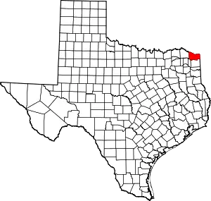
Beaver Dam is an unincorporated community in Bowie County, in the U.S. state of Texas.[1] According to the Handbook of Texas, the community had a population of 55 in 2000. It is located within the Texarkana metropolitan area.
History
Beaver Dam was named after a large beaver dam at a nearby creek. The predominantly black community did not have a post office, but it did have a business and 10 residents in 1933. The population increased to 25 in the 1940s and 1950s. By the 1980s, Beaver Dam had a church, cemetery, and scattered houses. In 2000, the population was 55.[2]
On April 2–3, 1982, an F3 tornado swept through the community, destroying five homes.[3][4]
Geography
Beaver Dam is located 14 mi (23 km) northwest of DeKalb in the northeastern part of the county.[2] It is also located 22 mi (35 km) northeast of Clarksville, 19 mi (31 km) northwest of New Boston, and 45 mi (72 km) west of Texarkana, just off Texas State Highway 59 and the intersection of two rural roads.[5]
Education
Beaver Dam is served by the DeKalb Independent School District.
References
- 1 2 U.S. Geological Survey Geographic Names Information System: Beaver Dam, Texas
- 1 2 Harper, Jr., Cecil (June 12, 2010). "Beaver Dam, TX". tshaonline.org. Retrieved December 2, 2017.
- ↑ Grazulis, Thomas P. (1993). Significant Tornadoes, 1680-1991: A Chronology and Analysis of Events. St. Johnsbury, Vermont: Environmental Films. ISBN 1-879362-03-1.
- ↑ National Weather Service (April 1982). "Storm Data and Unusual Weather Phenomena". Storm Data. Asheville, North Carolina: National Climatic Data Center. 24 (4).
- ↑ "Beaver Dam, Texas". Texas Escapes Online Magazine. Retrieved August 29, 2022.
