Beaverdam, Nevada | |
|---|---|
 Beaverdam  Beaverdam | |
| Coordinates: 37°40′52″N 114°27′8″W / 37.68111°N 114.45222°W | |
| Country | United States |
| State | Nevada |
| County | Lincoln |
| Area | |
| • Total | 0.69 sq mi (1.78 km2) |
| • Land | 0.69 sq mi (1.78 km2) |
| • Water | 0.00 sq mi (0.00 km2) |
| Elevation | 4,600 ft (1,400 m) |
| Population (2020) | |
| • Total | 40 |
| • Density | 58.22/sq mi (22.47/km2) |
| Time zone | UTC-8 (Pacific (PST)) |
| • Summer (DST) | UTC-7 (PDT) |
| ZIP code | 89008[2] |
| Area code | 775 |
| FIPS code | 32-05125 |
Beaverdam is a census-designated place in Lincoln County, Nevada, United States. As of the 2010 census it had a population of 44.[3]
Geography
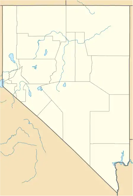
Beaverdam is located in the Meadow Valley, east of U.S. Route 93, 9 miles (14 km) south of Panaca and 6 miles (10 km) north of Caliente.
According to the U.S. Census Bureau, the Beaverdam CDP has an area of 0.6 square miles (1.6 km2), all of it land.[4]
Demographics
| Census | Pop. | Note | %± |
|---|---|---|---|
| 2020 | 40 | — | |
| U.S. Decennial Census[5] | |||
References
- ↑ "ArcGIS REST Services Directory". United States Census Bureau. Retrieved September 19, 2022.
- ↑ "Beaverdam NV ZIP Code". zipdatamaps.com. 2023. Retrieved June 16, 2023.
- ↑ "Total Population: 2010 Census DEC Summary File 1 (P1), Beaverdam CDP, Nevada". data.census.gov. U.S. Census Bureau. Retrieved May 4, 2020.
- ↑ "U.S. Gazetteer Files: 2019: Places: Nevada". U.S. Census Bureau Geography Division. Retrieved April 30, 2020.
- ↑ "Census of Population and Housing". Census.gov. Retrieved June 4, 2016.
Municipalities and communities of Lincoln County, Nevada, United States | ||
|---|---|---|
| City | 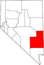 Lincoln County map | |
| CDPs | ||
| Other communities | ||
| Ghost towns | ||
| Proposed communities | ||
| Footnotes | ‡This populated place also has portions in an adjacent county or counties | |
This article is issued from Wikipedia. The text is licensed under Creative Commons - Attribution - Sharealike. Additional terms may apply for the media files.