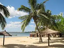
Belalanda | |
|---|---|
 A baobab in Mangily, Belalanda | |
 Belalanda Location in Madagascar | |
| Coordinates: 23°17′S 43°39′E / 23.283°S 43.650°E | |
| Country | |
| Region | Atsimo-Andrefana |
| District | Toliara II |
| Government | |
| • Mayor | Bien-Aimé Fanampia |
| Elevation | 12 m (39 ft) |
| Population (2001)[3] | |
| • Total | 7,000 |
| Time zone | UTC3 (EAT) |
| Postal code | 602 |
Belalanda is a rural municipality in Madagascar. It belongs to the district of Toliara II, which is a part of Atsimo-Andrefana Region. The population of the commune was estimated to be approximately 7,000 in 2001 commune census.[3]
History
First installations at Belalanda were made around 1700, known at that time as Ampasintanga by the Mahafaly. These have migrated since to Toliara and presently the municipality is mostly inhabited by Vezo people.[4]
Belalanda is served by a local airport. Primary and junior level secondary education are available in town. The majority 60% of the population works in fishing. 19% are farmers, while an additional 20% receives their livelihood from raising livestock. The most important crop is cassava, while other important products are sugarcane, maize and sweet potatoes. Services provide employment for 1% of the population.[3]
Geography
Belalanda lies at the Northern banks of the mouth of the lower Fiherenana River, 10 km North of Tulear.[5]
Roads
This municipality is crossed by the National road 9 (RN9).
Tourism

The beach of Mangily and Ifaty,[6] high spots of tourism in the area of Tulear are situated on the territory of the municipality of Belalanda.[7]
Wildlife
It is home of the endangered chameleon Furcifer belalandaensis. In the village of Amondrolava this municipality disposes of one of the largest mangrove forests in southern Madagascar.
Notable people
- Mahasumpo Raveloson (1909–1966), politician
References
- ↑ Furcifer_belalandaensis
- ↑ Estimated based on DEM data from Shuttle Radar Topography Mission
- 1 2 3 "ILO census data". Cornell University. 2002. Retrieved 2008-03-13.
- ↑ – SEQUESTRATION DE CARBONE DANS LA MANGROVE D’AMBONDROLAVA DU SUD-OUEST DE MADAGASCAR
- ↑ LES STRATEGIES PAYSANNES DE DEVELOPPEMENT LES STRATEGIES PAYSANNES DE DEVELOPPEMENT DANS LA COMMUNE RURALE DE MIARY
- ↑ TOURISME DANS LA REGION DE TOLIARA: CAS D’IFATY – MANGILY ET ANAKAO
- ↑ L'Express de Madagascar: Mangily
23°17′S 43°39′E / 23.283°S 43.650°E
