Belgravia | |
|---|---|
Neighbourhood | |
 Residential street in Belgravia | |
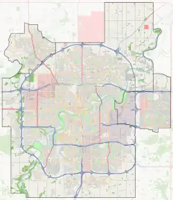
 Belgravia Location of Belgravia in Edmonton | |
| Coordinates: 53°30′40″N 113°31′59″W / 53.511°N 113.533°W | |
| Country | |
| Province | |
| City | Edmonton |
| Quadrant[1] | NW |
| Ward[1] | papastew |
| Sector[2] | Mature area |
| Area[3] | Strathcona |
| Government | |
| • Administrative body | Edmonton City Council |
| • Councillor | Michael Janz |
| Area | |
| • Total | 0.87 km2 (0.34 sq mi) |
| Elevation | 672 m (2,205 ft) |
| Population (2012)[6] | |
| • Total | 2,141 |
| • Density | 2,460.9/km2 (6,374/sq mi) |
| • Change (2009–12) | |
| • Dwellings | 974 |
Belgravia is a residential neighbourhood located in Edmonton, Alberta. It is located southwest of the University of Alberta main campus. Named after the Belgravia area of 19th-century London, the neighbourhood was once the southern terminus of the Edmonton Radial Railway. The McKernan/Belgravia LRT Station is located adjacent to the neighbourhood at the northwest corner of 114 Street and 76 Avenue in neighbouring McKernan.
To the west, Belgravia overlooks the North Saskatchewan River valley. The southern boundary is Belgravia Road, and the southwest portion of the neighbourhood overlooks Fox Drive. The north boundary between Saskatchewan Drive and 118 Street is University Avenue. From 118 Street, the neighbourhood boundary zigzags in a southeast direction from the intersection of University Avenue and 115A Street to the intersection of 114 Street and 76 Avenue. The eastern boundary between 76 Avenue and Belgravia Road is 114 Street.
Surrounding neighbourhoods are Windsor Park to the north, the University of Alberta to the northeast, McKernan to the east, Parkallen to the southeast, and the Neil Crawford Centre and University of Alberta Farm to the south. Grandview Heights is located to the southwest beyond Fox Drive.[7]
The community is represented by the Belgravia Community League, established in 1954, which maintains a community hall and outdoor rink located at 115 Street and 73 Avenue.[8][9]
Demographics
In the City of Edmonton's 2012 municipal census, Belgravia had a population of 2,141 living in 974 dwellings,[6] a -1.8% change from its 2009 population of 2,180.[10] With a land area of 0.87 km2 (0.34 sq mi), it had a population density of 2,460.9 people/km2 in 2012.[5][6]
Residential development
Three out of four residences in Belgravia are owner-occupied, with roughly four out of five residences being built prior to 1961. The majority of residences (72%) are single-family dwellings. The average household size is 2.4 people, with two out of three households having one or two people.
Transportation
Belgravia is one of two neighbourhoods served by the McKernan/Belgravia LRT Station. The station was officially opened on April 25, 2009, with regular service commencing on April 26, 2009.
See also
References
- 1 2 "City of Edmonton Wards & Standard Neighbourhoods" (PDF). City of Edmonton. Archived from the original (PDF) on May 3, 2014. Retrieved February 13, 2013.
- ↑ "Edmonton Developing and Planned Neighbourhoods, 2011" (PDF). City of Edmonton. Archived from the original (PDF) on September 4, 2013. Retrieved February 13, 2013.
- ↑ History of Annexations (Map). City of Edmonton, Planning and Development Department.
- ↑ "City Councillors". City of Edmonton. Retrieved February 13, 2013.
- 1 2 "Neighbourhoods (data plus kml file)". City of Edmonton. Retrieved February 13, 2013.
- 1 2 3 "Municipal Census Results – Edmonton 2012 Census". City of Edmonton. Retrieved February 22, 2013.
- ↑ Neighbourhood boundaries determined using the map utility on the City of Edmonton web site.
- ↑ "Belgravia Community League". Belgravia Community League. Retrieved October 7, 2017.
- ↑ Kuban, Ron (2005). Edmonton's Urban Villages: The Community League Movement. University of Alberta Press. ISBN 9781459303249.
- ↑ "2009 Municipal Census Results". City of Edmonton. Retrieved February 22, 2013.