Belmont, Louisiana | |
|---|---|
 Belmont, Louisiana  Belmont, Louisiana | |
| Coordinates: 31°42′59″N 93°30′33″W / 31.71639°N 93.50917°W | |
| Country | United States |
| State | Louisiana |
| Parish | Sabine |
| Area | |
| • Total | 10.03 sq mi (25.98 km2) |
| • Land | 10.03 sq mi (25.98 km2) |
| • Water | 0.00 sq mi (0.00 km2) |
| Elevation | 351 ft (107 m) |
| Population (2020) | |
| • Total | 305 |
| • Density | 30.41/sq mi (11.74/km2) |
| Time zone | UTC-6 (Central (CST)) |
| • Summer (DST) | UTC-5 (CDT) |
| Area code | 318 |
| GNIS feature ID | 553595[2] |
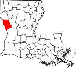
Belmont is an unincorporated community and census-designated place in Sabine Parish, Louisiana, United States. Its population was 361 as of the 2010 census.[3] The community is located at the junction of Louisiana highways 120 and 175.
Geography
According to the U.S. Census Bureau, the community has an area of 10.031 square miles (25.98 km2), all land.[3]
Demographics
| Census | Pop. | Note | %± |
|---|---|---|---|
| 2020 | 305 | — | |
| U.S. Decennial Census[4] | |||
References
- ↑ "2020 U.S. Gazetteer Files". United States Census Bureau. Retrieved March 20, 2022.
- ↑ "Belmont". Geographic Names Information System. United States Geological Survey, United States Department of the Interior.
- 1 2 "2010 Census Gazetteer Files - Places: Louisiana". U.S. Census Bureau. Retrieved January 14, 2017.
- ↑ "Census of Population and Housing". Census.gov. Retrieved June 4, 2016.
This article is issued from Wikipedia. The text is licensed under Creative Commons - Attribution - Sharealike. Additional terms may apply for the media files.
