Bentelo
Beantel | |
|---|---|
 Church in Bentelo | |
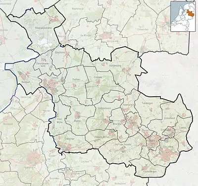
 Bentelo Location in province of Overijssel in the Netherlands  Bentelo Bentelo (Netherlands) | |
| Coordinates: 52°13′29″N 6°41′2″E / 52.22472°N 6.68389°E | |
| Country | Netherlands |
| Province | Overijssel |
| Municipality | Hof van Twente |
| Area | |
| • Total | 29.42 km2 (11.36 sq mi) |
| Elevation | 17 m (56 ft) |
| Population (2021)[1] | |
| • Total | 2,205 |
| • Density | 75/km2 (190/sq mi) |
| Time zone | UTC+1 (CET) |
| • Summer (DST) | UTC+2 (CEST) |
| Postal code | 7495 & 7497[1] |
| Dialing code | 0547 |
Bentelo (Low German: Beantel) is a farming village in the Dutch municipality Hof van Twente.
Overview
It was first mentioned in 1188 as Benlo. The etymology is unclear.[3] Bentelo started to develop after World War II. The Catholic church was completed in 1954.[4] In 1840, it was home to 504 people.[5]
The village is a centre for intensive cattle farming. Bentelo has a large vineyard in the Netherlands,[6] as well as several Asparagus growers.[5]
Notable people
- Klaas Annink (Huttenkloas) (1710–1775), criminal from Twente. Place of birth is disputed[5]
- Moniek Kleinsman (born 1982), speed skater[7]
Gallery
 Pet hotel
 The Boddenbroek
References
- 1 2 3 "Kerncijfers wijken en buurten 2021". Central Bureau of Statistics. Retrieved 16 March 2022.
Postal code 7497 is the village proper
- ↑ "Postcodetool for 7497LA". Actueel Hoogtebestand Nederland (in Dutch). Het Waterschapshuis. Retrieved 16 March 2022.
- ↑ "Bentelo - (geografische naam)". Etymologiebank (in Dutch). Retrieved 16 March 2022.
- ↑ Ronald Stenvert & Jan ten Hove (1998). "Bentelo" (in Dutch). Zwolle: Waanders. ISBN 90 400 9200 1. Retrieved 16 March 2022.
- 1 2 3 "Bentelo". Plaatsengids (in Dutch). Retrieved 16 March 2022.
- ↑ "Wijngaard Hof van Twente – Bentelo". Wijn en Wijngaard (in Dutch). Retrieved 16 March 2022.
- ↑ "Hoe is het met Moniek Kleinsman? 'In de politiek kan ik iets voor de sport betekenen'". Schaatsen (in Dutch). Retrieved 16 March 2022.
Wikimedia Commons has media related to Bentelo.
This article is issued from Wikipedia. The text is licensed under Creative Commons - Attribution - Sharealike. Additional terms may apply for the media files.