| Besbre | |
|---|---|
 The Besbre at Jaligny-sur-Besbre | |
 | |
| Location | |
| Country | France |
| Physical characteristics | |
| Source | |
| • location | Massif Central |
| Mouth | |
• location | Loire |
• coordinates | 46°33′10″N 3°43′54″E / 46.55278°N 3.73167°E |
| Length | 106 km (66 mi) |
| Basin size | 762 km2 (294 sq mi) |
| Basin features | |
| Progression | Loire→ Atlantic Ocean |
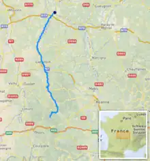
The Besbre (French pronunciation: [bɛbʁ]) is a river in central France, a left tributary of the Loire. It is 106 km (66 mi) long.[1] Its source is on the mountain of Puy de Montoncel, northeast of Thiers, in the Massif Central. The Besbre flows generally north, through the following departments and towns:
The Besbre flows into the river Loire 3 kilometres (2 mi) north of Dompierre-sur-Besbre.
References
Wikimedia Commons has media related to Besbre.
This article is issued from Wikipedia. The text is licensed under Creative Commons - Attribution - Sharealike. Additional terms may apply for the media files.