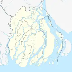
Bhola Sadar
ভোলা সদর | |
|---|---|
 Bhola Sadar Location in Bangladesh | |
| Coordinates: 22°41′10″N 90°38′17″E / 22.686°N 90.638°E | |
| Country | |
| Division | Barisal Division |
| District | Bhola District |
| Area | |
| • Total | 413.16 km2 (159.52 sq mi) |
| Population (2011) | |
| • Total | 430,520 |
| • Density | 1,000/km2 (2,700/sq mi) |
| Time zone | UTC+6 (BST) |
| Website | Official Map of the Bhola Sadar Upazila |
Bhola Sadar (Bengali: ভোলা সদর) is an upazila of Bhola District in Barisal Division, Bangladesh.[1] It contains the district headquarters, Bhola.
Geography
Bhola Sadar is located at 22°41′25″N 90°39′09″E / 22.6903°N 90.6525°E. It has a total area of 413.16 km2 (159.52 sq mi). It is bounded by Mehendiganj and Lakshmipur Sadar upazilas on the north, Bauphal and Burhanuddin upazilas on the south, Daulatkhan upazila on the east, Barisal sadar, Mehendiganj and Bakerganj upazilas on the west.[1]
Demographics
| Year | Pop. (000) | ±% |
|---|---|---|
| 1981 | 284 | — |
| 1991 | 352 | +23.9% |
| 2001 | 408 | +15.9% |
| 2011 | 431 | +5.6% |
| Source: Bangladesh Bureau of Statistics[2] | ||
According to the 2011 Bangladesh census, Bhola Sadar Upazila had 88,068 households and a population of 430,520, 20.3% of whom lived in urban areas. 11.8% of the population was under the age of 5. The literacy rate (age 7 and over) was 45.2%, compared to the national average of 51.8%.[3][4]
Administration
Bhola Thana was formed in 1842 and it was turned into an upazila on 1 February, 1984.[5]
Bhola Sadar Upazila is divided into Bhola Municipality and 13 union parishads: Alinagor, Bapta, Charshamya, Dakshin Digholdi, Dhania, Ilisha, Kachia, Paschim Ilisa, Razapur, Shibpur, Uttar Digholdi, Vheduria, and Vhelumia. The union parishads are subdivided into 92 mauzas and 108 villages.[2]
Bhola Municipality is subdivided into 9 wards and 19 mahallas.[2]
Notable residents
- Tofail Ahmed, the Member of Parliament (MP) for constituency Bakerganj-1 from 1973 to 1975,[6] for Bhola-2 from 1986 to 1988,[7] for Bhola-1 from 1991 to 1996,[8] and for Bhola-2 again from 1996 to 2001 and 2009 until 2014,[9][10] has been MP for constituency Bhola-1 again since 2014.[11]
- Andaleeve Rahman Partho was Member of Parliament for constituency Bhola-1 from 2009 to 2014.[10]
- Sayed Kamaluddin Zafree, Islamic scholar, was born in Bhola.[12]
See also
References
- 1 2 Md Mizanur Rahman (2012). "Bhola Sadar Upazila". In Sirajul Islam and Ahmed A. Jamal (ed.). Banglapedia: National Encyclopedia of Bangladesh (Second ed.). Asiatic Society of Bangladesh.
- 1 2 3 "District Statistics 2011: Bhola" (PDF). Bangladesh Bureau of Statistics. Archived from the original (PDF) on 13 November 2014. Retrieved 14 July 2014.
- ↑ "Community Report: Bhola" (PDF). Population & Housing Census 2011. Bangladesh Bureau of Statistics. Retrieved 2018-08-15.
- ↑ "Population and Housing Census 2011: Bangladesh at a Glance" (PDF). Bangladesh Bureau of Statistics. Archived from the original (PDF) on July 28, 2014. Retrieved July 21, 2014.
- ↑ "Bhola Sadar Upazila - Banglapedia". en.banglapedia.org. Retrieved 2023-03-01.
- ↑ "List of 1st Parliament Members". Bangladesh Parliament.
- ↑ "List of 3rd Parliament Members". Bangladesh Parliament.
- ↑ "List of 5th Parliament Members". Bangladesh Parliament.
- ↑ "List of 7th Parliament Members". Bangladesh Parliament.
- 1 2 "List of 9th Parliament Members". Bangladesh Parliament.
- ↑ "Constituency 115_10th_En". Bangladesh Parliament.
- ↑ "Biography". Sayed Kamaluddin Zafree.
