| Black River | |
|---|---|
.jpg.webp) The river at the community of Sutton | |
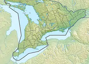
 Location of the mouth of the Black River in southern Ontario | |
| Location | |
| Country | Canada |
| Province | Ontario |
| Region | Central Ontario |
| Regional Municipalities | |
| Municipalities | |
| Physical characteristics | |
| Source | Unnamed pond |
| • location | Whitchurch–Stouffville |
| • coordinates | 44°03′20″N 79°20′07″W / 44.05556°N 79.33528°W |
| • elevation | 291 m (955 ft) |
| Mouth | Lake Simcoe |
• location | Georgina |
• coordinates | 44°19′21″N 79°20′48″W / 44.32250°N 79.34667°W |
• elevation | 219 m (719 ft) |
| Basin size | 375 km2 (145 sq mi) |
| Discharge | |
| • location | Black River at Sutton (WSC 02EC0120) |
| • average | 2.61 m3/s (92 cu ft/s) |
| • minimum | 1.76 m3/s (62 cu ft/s) |
| • maximum | 3.58 m3/s (126 cu ft/s) |
| Basin features | |
| River system | Great Lakes Basin |
The Black River is a river in the Regional Municipality of York and the Regional Municipality of Durham in Central Ontario, Canada.[1] It is part of the Great Lakes Basin, and is a tributary of Lake Simcoe; the entire watershed is under the auspices of the Lake Simcoe Region Conservation Authority.[2]
Watershed
The watershed is 375 square kilometres (145 sq mi) in area[2] and the mean flow reported at the community of Sutton, which encompassed 324 square kilometres (125 sq mi) of the watershed, was 2.61 cubic metres (92.17 cu ft) (max flow 3.58 cubic metres or 126.43 cubic feet; min flow 1.76 cubic metres or 62.15 cubic feet).[3] The mean flow at a station further upstream at the community of Baldwin, which encompassed 271.78 square kilometres (104.93 sq mi) of the watershed, was 2.2 cubic metres (78 cu ft) (max flow 3.05 cubic metres or 107.71 cubic feet; min flow 1.35 cubic metres or 47.67 cubic feet).[4]
Course
The river begins at an unnamed lake on the Oak Ridges Moraine in Whitchurch–Stouffville, York Region, near the community of Cedar Valley. It heads northwest, under the Canadian National Railway main line, and then north into East Gwillimbury, then flows northeast under Ontario Highway 48 to cross the northwestern corner of Uxbridge, Durham Region. It flows under the former Lake Simcoe Railway branch of the Toronto and Nipissing Railway, before returning to Georgina in York Region. It heads north, passes over the Baldwin Dam at the community of Baldwin, flows through the community of Sutton, and reaches its mouth at Lake Simcoe between the communities of Briars Park to the west and Mossington Park to the east. Lake Simcoe flows via Lake Couchiching and the Severn River to Lake Huron.
Recreation
Baldwin Conservation Area is a 26-hectare (64-acre) conservation area on a small reservoir formed by the Baldwin Dam.[5] The Sutton-Zephyr rail trail occupies a portion of the abandoned Lake Simcoe Railway branch of the Toronto and Nipissing Railway that crosses the Black River.[6]
Tributaries
- Zephyr Creek (right)
- Mount Albert Creek (right)
- Harrison Creek (left)
See also
References
- ↑ "Black River". Geographical Names Data Base. Natural Resources Canada. Retrieved 2014-06-10.
- 1 2 "Black River Subwatershed Plan" (PDF). Lake Simcoe Region Conservation Authority. 2010. Archived from the original (PDF) on 2011-11-06. Retrieved 2014-06-10.
- ↑ "Black River at Sutton (02EC0120)". Water Survey of Canada - Environment Canada. 2010-04-30. Archived from the original on 2014-06-11. Retrieved 2014-06-10.
- ↑ "Black River at Baldwin (02EC008)". Water Survey of Canada - Environment Canada. 2010-04-30. Archived from the original on 2014-06-11. Retrieved 2014-06-10.
- ↑ "Baldwin Conservation Area". Lake Simcoe Region Conservation Authority. Archived from the original on 2015-06-07. Retrieved 2014-06-10.
- ↑ "Sutton-Zephyr Rail Trail". Town of East Gwillimbury. Archived from the original on 2014-02-13. Retrieved 2014-06-10.
Other map sources:
- Map 3 (PDF) (Map). 1 : 700,000. Official road map of Ontario. Ministry of Transportation of Ontario. 2010-01-01. Retrieved 2014-06-10.
- Restructured municipalities - Ontario map #6 (Map). Restructuring Maps of Ontario. Ontario Ministry of Municipal Affairs and Housing. 2006. Archived from the original on 2021-02-24. Retrieved 2014-06-10.
- Lake Simcoe Region Conservation Authority - Sub-Watersheds (PDF) (Map). Lake Simcoe Region Conservation Authority. 2008. Archived from the original (PDF) on 2016-03-04. Retrieved 2014-06-10.