Black Tickle Airport | |||||||||||
|---|---|---|---|---|---|---|---|---|---|---|---|
 | |||||||||||
| Summary | |||||||||||
| Airport type | Public | ||||||||||
| Operator | Government of Newfoundland and Labrador | ||||||||||
| Location | Black Tickle, Newfoundland and Labrador | ||||||||||
| Time zone | AST (UTC−04:00) | ||||||||||
| • Summer (DST) | ADT (UTC−03:00) | ||||||||||
| Elevation AMSL | 52 ft / 16 m | ||||||||||
| Coordinates | 53°28′12″N 055°47′15″W / 53.47000°N 55.78750°W | ||||||||||
| Map | |||||||||||
 CCE4 Location in Newfoundland and Labrador | |||||||||||
| Runways | |||||||||||
| |||||||||||
Sources: Canada Flight Supplement[1] | |||||||||||
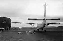
Black Tickle Airport (IATA: YBI, TC LID: CCE4) is 1 nautical mile (1.9 km; 1.2 mi) northwest of Black Tickle, Newfoundland and Labrador, Canada.
References
External links
- Black Tickle Airport on COPA's Places to Fly airport directory
- Accident history for YBI: Black Tickle Airport at Aviation Safety Network
| By name | |
|---|---|
| By location indicator | |
| By province/territory | |
| By area | |
| National Airports System | |
| Related | |
| |
This article is issued from Wikipedia. The text is licensed under Creative Commons - Attribution - Sharealike. Additional terms may apply for the media files.