| Blackbeck Tarn | |
|---|---|
 | |
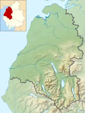
 Blackbeck Tarn Location in the Lake District National Park | |
| Location | Lake District, Cumbria |
| Coordinates | 54°30′15″N 3°14′2″W / 54.50417°N 3.23389°W |
| Type | Tarn |
| Basin countries | United Kingdom |
| Max. length | 183 m (600 ft) |
| Max. width | 80 m (260 ft) |
| Surface area | 0.95 hectares (2.3 acres) |
| Max. depth | 2.5 m (8.2 ft) |
| Surface elevation | 486 m (1,594 ft) |
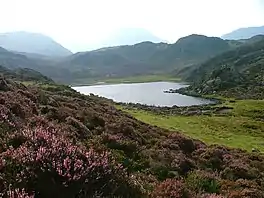
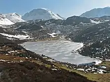
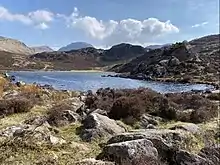
Blackbeck Tarn is a small tarn in Cumbria, England, situated near the summit of Haystacks in the Buttermere Valley.[1] At an elevation of 486 m (1,594 ft), the lake has an area of 0.95 hectares (2.3 acres) and measures 183 m × 80 m (600 ft × 262 ft), with a maximum depth of 2.5 m (8.2 ft).[2]
References
Wikimedia Commons has media related to Blackbeck Tarn.
- ↑ Services, Good Stuff IT. "Blackbeck Tarn, Cumbria - British Lakes". British Lakes. Retrieved 19 January 2017.
- ↑ "Blackbeck Tarn". f22.org.uk. Retrieved 25 July 2012.
This article is issued from Wikipedia. The text is licensed under Creative Commons - Attribution - Sharealike. Additional terms may apply for the media files.