Bleury | |
|---|---|
Part of Auneau-Bleury-Saint-Symphorien | |
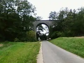 Viaduct | |
Location of Bleury | |
 Bleury  Bleury | |
| Coordinates: 48°31′14″N 1°44′54″E / 48.5206°N 1.7483°E | |
| Country | France |
| Region | Centre-Val de Loire |
| Department | Eure-et-Loir |
| Arrondissement | Chartres |
| Canton | Auneau |
| Commune | Auneau-Bleury-Saint-Symphorien |
| Area 1 | 7.85 km2 (3.03 sq mi) |
| Population (2016)[1] | 405 |
| • Density | 52/km2 (130/sq mi) |
| Time zone | UTC+01:00 (CET) |
| • Summer (DST) | UTC+02:00 (CEST) |
| Postal code | 28700 |
| Elevation | 113–156 m (371–512 ft) (avg. 128 m or 420 ft) |
| 1 French Land Register data, which excludes lakes, ponds, glaciers > 1 km2 (0.386 sq mi or 247 acres) and river estuaries. | |
Bleury (French pronunciation: [blœʁi]) is a former commune in the Eure-et-Loir department in northern France. In January 2012 it merged with Saint-Symphorien-le-Château into the new commune Bleury-Saint-Symphorien, which was merged into Auneau-Bleury-Saint-Symphorien on 1 January 2016.
Population
| Year | Pop. | ±% |
|---|---|---|
| 1962 | 162 | — |
| 1968 | 164 | +1.2% |
| 1975 | 176 | +7.3% |
| 1982 | 270 | +53.4% |
| 1990 | 395 | +46.3% |
| 1999 | 422 | +6.8% |
| 2008 | 488 | +15.6% |
See also
References
Wikimedia Commons has media related to Bleury (Eure-et-Loir).
This article is issued from Wikipedia. The text is licensed under Creative Commons - Attribution - Sharealike. Additional terms may apply for the media files.