| Bolsterstone | |
|---|---|
 | |
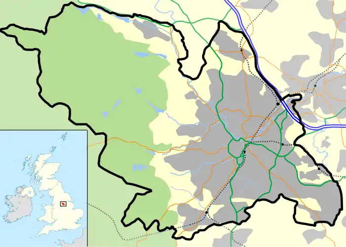
 Bolsterstone Location within Sheffield | |
| Metropolitan borough | |
| Metropolitan county | |
| Region | |
| Country | England |
| Sovereign state | United Kingdom |
| Post town | SHEFFIELD |
| Postcode district | S36 |
| Dialling code | 0114 |
| Police | South Yorkshire |
| Fire | South Yorkshire |
| Ambulance | Yorkshire |
| UK Parliament | |
Bolsterstone is a village in South Yorkshire, England, south of Stocksbridge, and 8.5 miles to the northwest of the City of Sheffield and within the city borough. It lies on the border of the Peak District national park. Bolsterstone had a population of 386 in 2011.[1]
Geography and history
Bolsterstone is less than 1 km south of the town of Stocksbridge within the civil parish of Stocksbridge,[2] and the electoral ward of Stocksbridge and Upper Don.[3] The village is at a height of around 300 m (980 ft) above sea level on the northern side of the east–west Ewden valley, north of Broomhead and More Hall reservoirs.[2]
The origin of the name "Bolsterstone" is unknown; it may a corruption of the root word "Walder" (also used in local place names, including a barrow[4]), or may refer to two large stones in the village, which are referred to as the "Bolster Stones". The village is thought to have been established in the Anglo-Saxon period.[5] St Mary's Church was founded in 1412, and a fortified manor house ("Bolsterstone Castle") is thought to have been built by an Earl of Shrewsbury.[6] Two buildings dating from the 16th or 17th century are thought to be remnants of the castle: Castle Cottages are mostly 19th-century with parts of walls dating from the earlier period;[7] Porters Lodge, also mostly 19th-century, is thought to contain elements of the castle gatehouse.[8]
A Free School was built in the village in 1686 (rebuilt 1780). Land around the village was enclosed after 1778, and St. Mary's church was rebuilt in the 1790s.[9] In 1802 the entire manor of Bolsterstone, over 3,460 acres (14.0 km2) was put up for sale, and acquired by James Rimington.[10][11]
The Castle Inn was built in 1840;[12] Bolsterstone National School in 1851/2 and the Free School rebuilt in 1857;[13][14] and a vicarage built in 1862; between 1872 and 1879 St Mary's church was again rebuilt.[13]
As of 2009 the village functions as a residential village; the village has no shops, and both schools have closed; the National School building is used as a village hall.[15]
The Peak District Boundary Walk runs through the village.[16]
People
Three first-class cricketers were born in Bolsterstone: the brothers Clem, Rowland and Rockley Wilson.

References
- ↑ Bolsterstone is made up of Output Area E00041273 in the Stocksbridge and Upper Don ward http://ukcensusdata.com/stocksbridge-and-upper-don-e00041273#A39e7ccp.dpbs
- 1 2 Ordnance survey. 1:25000. c.2012
- ↑ "Area: Bradfield CP (Parish)", 2001 Census: Key Statistics, Office for National Statistics
- ↑ Historic England. "Walders Low (312570)". Research records (formerly PastScape). Retrieved 26 February 2014.
- ↑ Bolsterstone Conservation Area Appraisal (2009), 3.3–3.4
- ↑ Bolsterstone Conservation Area Appraisal (2009), 3.5–3.6
- ↑ Historic England. "Castle Cottage (312545)". Research records (formerly PastScape). Retrieved 26 February 2014.
- ↑ Historic England. "Porters Lodge (312605)". Research records (formerly PastScape). Retrieved 26 February 2014.
- ↑ Bolsterstone Conservation Area Appraisal (2009), 3.9–3.11
- ↑ Bolsterstone Conservation Area Appraisal (2009), 3.12
- ↑ "(Bolsterstone for sale)", The Times, 4 August 1802
- ↑ Bolsterstone Area (S&DHS), The Castle Inn Public House
- 1 2 Bolsterstone Conservation Area Appraisal (2009), 3.13–3.16
- ↑ Bolsterstone Area (S&DHS), Bolsterstone Schools
- ↑ Bolsterstone Conservation Area Appraisal (2009), 3.17, 4.4–4.5
- ↑ McCloy, Andrew (2017). Peak District Boundary Walk: 190 Miles Around the Edge of the National Park. Friends of the Peak District. ISBN 978-1909461536.
Sources
- "Bolsterstone Extension – Conservation Area Appraisal" (PDF), www.peakdistrict.gov.uk, February 2009, archived from the original (PDF) on 30 August 2012, retrieved 15 September 2012
- Bolsterstone Area, Stocksbridge & District History Society (S&DHS)
Literature
- Hunter, Joseph (1819), "The Chapelry of Bradfield – Bolsterstone", Hallamshire: The History and Topography of the Parish of Sheffield in the county of York : with Historical and Descriptive Notices of the Parishes of Ecclesfield, Hansworth, Treeton and Whiston, and of the Chapelry of Bradfield, Lackington, Hughes, Harding. Mayor, and Jones, pp. 280–281
- Kenworthy, Joseph (1915), "Bolsterstone", The Early History Of Stocksbridge & District, no. 15
External links
- BOLSTERSTONE, Stocksbridge Town Council
- "Bolsterstone Genealogy Project", www.bolsterstone.de
- "Bolsterstone Community Group", www.bolsterstone.info
- Sources for the history of Bolsterstone Produced by Sheffield City Council's Libraries and Archives