Bonloc
Lekuine | |
|---|---|
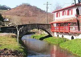 The bridge of Bonloc/Lekuine, over the Aran river | |
.svg.png.webp) Coat of arms | |
Location of Bonloc | |
 Bonloc  Bonloc | |
| Coordinates: 43°22′09″N 1°15′55″W / 43.3692°N 1.2653°W | |
| Country | France |
| Region | Nouvelle-Aquitaine |
| Department | Pyrénées-Atlantiques |
| Arrondissement | Bayonne |
| Canton | Pays de Bidache, Amikuze et Ostibarre |
| Intercommunality | CA Pays Basque |
| Government | |
| • Mayor (2020–2026) | Michel Etcheverry[1] |
| Area 1 | 1.02 km2 (0.39 sq mi) |
| Population | 367 |
| • Density | 360/km2 (930/sq mi) |
| Time zone | UTC+01:00 (CET) |
| • Summer (DST) | UTC+02:00 (CEST) |
| INSEE/Postal code | 64134 /64240 |
| Elevation | 51–146 m (167–479 ft) (avg. 123 m or 404 ft) |
| 1 French Land Register data, which excludes lakes, ponds, glaciers > 1 km2 (0.386 sq mi or 247 acres) and river estuaries. | |
Bonloc (French pronunciation: [bɔ̃lɔk]; Basque: Lekuine)[3] is a commune in the Pyrénées-Atlantiques department in southwestern France.
A resident of Bonloc is known as a Lekuindar in Basque.[3]
See also
References
- ↑ "Répertoire national des élus: les maires". data.gouv.fr, Plateforme ouverte des données publiques françaises (in French). 2 December 2020.
- ↑ "Populations légales 2021". The National Institute of Statistics and Economic Studies. 28 December 2023.
- 1 2 LEKUINE, Auñamendi Eusko Entziklopedia (in Spanish)
Wikimedia Commons has media related to Bonloc.
Municipalities in Labourd (Lapurdi) | ||
|---|---|---|
|  | |
This article is issued from Wikipedia. The text is licensed under Creative Commons - Attribution - Sharealike. Additional terms may apply for the media files.