Bourgtheroulde-Infreville | |
|---|---|
Part of Grand-Bourgtheroulde | |
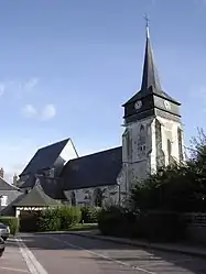 Church of Saint Laurent | |
.svg.png.webp) Coat of arms | |
Location of Bourgtheroulde-Infreville | |
 Bourgtheroulde-Infreville  Bourgtheroulde-Infreville | |
| Coordinates: 49°17′57″N 0°52′28″E / 49.2992°N 0.8744°E | |
| Country | France |
| Region | Normandy |
| Department | Eure |
| Arrondissement | Bernay |
| Canton | Bourgtheroulde-Infreville |
| Commune | Grand-Bourgtheroulde |
| Area 1 | 11.62 km2 (4.49 sq mi) |
| Population (2017)[1] | 3,171 |
| • Density | 270/km2 (710/sq mi) |
| Time zone | UTC+01:00 (CET) |
| • Summer (DST) | UTC+02:00 (CEST) |
| Postal code | 27520 |
| Elevation | 96–158 m (315–518 ft) |
| 1 French Land Register data, which excludes lakes, ponds, glaciers > 1 km2 (0.386 sq mi or 247 acres) and river estuaries. | |
Bourgtheroulde-Infreville (French pronunciation: [buʁtəʁuld ɛ̃fʁəvil]) is a former commune in the Eure department in Normandy in northern France. It is the seat of the commune of Grand-Bourgtheroulde.
History
The Battle of Bourgthéroulde was fought between English loyalist and Norman rebels in 1124. On 1 January 2016, Bosc-Bénard-Commin, Bourgtheroulde-Infreville and Thuit-Hébert merged, becoming one commune called Grand-Bourgtheroulde.[2]
Population
|
|
See also
References
- ↑ Téléchargement du fichier d'ensemble des populations légales en 2017, INSEE
- ↑ Arrêté préfectoral 9 December 2015 (in French)
External links
Wikimedia Commons has media related to Bourgtheroulde-Infreville.
This article is issued from Wikipedia. The text is licensed under Creative Commons - Attribution - Sharealike. Additional terms may apply for the media files.