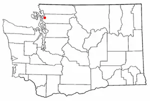
Bow is an unincorporated community in Skagit County, Washington. It is located near the towns of Bay View, Edison, Burlington, and Mount Vernon. Bow is included in the Mount Vernon-Anacortes, Washington Metropolitan Statistical Area. Bow overlooks Samish Bay. The population of Bow is 203 in the 2020 census.
The 2 ft (610 mm) narrow gauge[1] Bow Hill Railroad, complete with a working steam locomotive, is located in the Bow area. It can be found on the private property of Diz Schimke, who allows the public to ride the train during Christmastime in exchange for donations to the Alger food bank.[2]
History
Bow was originally known as Brownsville, after William J. Brown, who homesteaded the townsite in 1869.[3] The advent of the railroad resulted in a population boom and the need for a post office. Apparently inspired by the growth brought by the railroad, Brown suggested the new name of Bow, after the large railway station in London, England, which in turn was named for the bow or poplar tree. Although this is the most common belief, there are some who believe it was named after homesteader James T. Bow.
An alternate story claims that the settlement is named for a Norwegian immigrant family that settled in that area in the 1890s. Their last name was Boe.
For more information about the history of Bow, refer to the article, "The Birth of Brownsville and Bow, Skagit County".
Geography and location
Bow is located in Skagit County, Washington, in the Mount Vernon-Anacortes metro area. The original town of Bow was located off Bow Hill Road and included a church, a mercantile, and a hotel. Bow is often confused with the nearby town of Edison, on Samish Bay. Both Edison and Bow - as well as the nearby town of Blanchard - share the Bow zip code.
References
- ↑ Steamlocomotive.info - Standard Mining Co. No. 1
- ↑ Goskagit.com - Sidelined steam engine still ready for food drive
- ↑ Meany, Edmond S. (1923). Origin of Washington geographic names. Seattle: University of Washington Press. p. 26.
