Brélidy
Brelidi | |
|---|---|
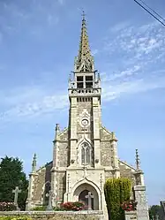 Church of St. Columban | |
Location of Brélidy | |
 Brélidy  Brélidy | |
| Coordinates: 48°39′37″N 3°13′01″W / 48.6603°N 3.2169°W | |
| Country | France |
| Region | Brittany |
| Department | Côtes-d'Armor |
| Arrondissement | Guingamp |
| Canton | Bégard |
| Intercommunality | Guingamp-Paimpol Agglomération |
| Government | |
| • Mayor (2020–2026) | Pierre-Marie Garel[1] |
| Area 1 | 8.14 km2 (3.14 sq mi) |
| Population | 304 |
| • Density | 37/km2 (97/sq mi) |
| Time zone | UTC+01:00 (CET) |
| • Summer (DST) | UTC+02:00 (CEST) |
| INSEE/Postal code | 22018 /22140 |
| Elevation | 35–111 m (115–364 ft) |
| 1 French Land Register data, which excludes lakes, ponds, glaciers > 1 km2 (0.386 sq mi or 247 acres) and river estuaries. | |
Brélidy (French pronunciation: [bʁelidi]; Breton: Brelidi) is a commune in the Côtes-d'Armor department of Brittany in northwestern France.
Population
| Year | Pop. | ±% |
|---|---|---|
| 1962 | 312 | — |
| 1968 | 357 | +14.4% |
| 1975 | 316 | −11.5% |
| 1982 | 336 | +6.3% |
| 1990 | 325 | −3.3% |
| 1999 | 335 | +3.1% |
| 2008 | 301 | −10.1% |
Inhabitants of Brélidy are called Brélidiens in French.
See also
References
- ↑ "Répertoire national des élus: les maires". data.gouv.fr, Plateforme ouverte des données publiques françaises (in French). 2 December 2020.
- ↑ "Populations légales 2021". The National Institute of Statistics and Economic Studies. 28 December 2023.
External links
Wikimedia Commons has media related to Brélidy.
- Base Mérimée: Search for heritage in the commune, Ministère français de la Culture. (in French)
This article is issued from Wikipedia. The text is licensed under Creative Commons - Attribution - Sharealike. Additional terms may apply for the media files.