Breitscheid | |
|---|---|
_COA.svg.png.webp) Coat of arms | |
Location of Breitscheid within Mainz-Bingen district 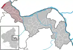 | |
 Breitscheid 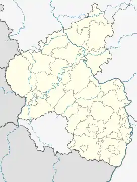 Breitscheid | |
| Coordinates: 50°03′25″N 7°42′29″E / 50.05694°N 7.70806°E | |
| Country | Germany |
| State | Rhineland-Palatinate |
| District | Mainz-Bingen |
| Municipal assoc. | Rhein-Nahe |
| Government | |
| • Mayor (2019–24) | Marcel Rüdesheim[1] |
| Area | |
| • Total | 5.29 km2 (2.04 sq mi) |
| Elevation | 360 m (1,180 ft) |
| Population (2021-12-31)[2] | |
| • Total | 150 |
| • Density | 28/km2 (73/sq mi) |
| Time zone | UTC+01:00 (CET) |
| • Summer (DST) | UTC+02:00 (CEST) |
| Postal codes | 55422 |
| Dialling codes | 06743 |
| Vehicle registration | MZ |
Breitscheid is an Ortsgemeinde – a municipality belonging to a Verbandsgemeinde, a kind of collective municipality – in the Mainz-Bingen district in Rhineland-Palatinate, Germany.
Geography
Location
Breitscheid lies in the Hunsrück between Koblenz and Bad Kreuznach. It belongs to the Verbandsgemeinde of Rhein-Nahe, whose seat is in Bingen am Rhein, although that town is not within its bounds. The placename comes from the Middle High German breit and -scheid: “wooded ridge”.
Politics
Municipal council
The council is made up of 5 council members who were elected by majority vote in a municipal election held on 2 March 2008.
Coat of arms
The municipality's arms might be described thus: Per pale argent a cross sable and gules in chief sinister a mullet of six, and in base a mound royal ensigned with a cross crosslet Or.
Economy and infrastructure
Transport
Autobahn A 61 can be reached after a drive of roughly 10 km.
References
- ↑ Direktwahlen 2019, Landkreis Mainz-Bingen, Landeswahlleiter Rheinland-Pfalz, accessed 4 August 2021.
- ↑ "Bevölkerungsstand 2021, Kreise, Gemeinden, Verbandsgemeinden" (in German). Statistisches Landesamt Rheinland-Pfalz. 2022.
External links
- Official website
 (in German)