Breme
| |
|---|---|
| Comune di Breme | |
Location of Breme | |
 Breme Location of Breme in Italy 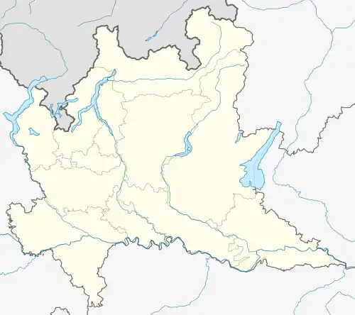 Breme Breme (Lombardy) | |
| Coordinates: 45°8′N 8°38′E / 45.133°N 8.633°E | |
| Country | Italy |
| Region | Lombardy |
| Province | Province of Pavia (PV) |
| Area | |
| • Total | 19.2 km2 (7.4 sq mi) |
| Elevation | 101 m (331 ft) |
| Population (Dec. 2004)[2] | |
| • Total | 889 |
| • Density | 46/km2 (120/sq mi) |
| Demonym | Bremesi |
| Time zone | UTC+1 (CET) |
| • Summer (DST) | UTC+2 (CEST) |
| Postal code | 27020 |
| Dialing code | 0384 |
| Website | Official website |
Breme (Lombard: Bräm) is a comune (municipality) in the Province of Pavia in the Italian region of Lombardy, located about 60 kilometres (37 mi) southwest of Milan and about 40 kilometres (25 mi) west of Pavia. As of 31 December 2004, it had a population of 889 and an area of 19.2 square kilometres (7.4 sq mi).[3]
Breme borders the following municipalities: Candia Lomellina, Frassineto Po, Sartirana Lomellina, Valle Lomellina, Valmacca.
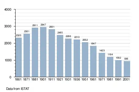
Demographic evolution
References
- ↑ "Superficie di Comuni Province e Regioni italiane al 9 ottobre 2011". Italian National Institute of Statistics. Retrieved 16 March 2019.
- ↑ "Popolazione Residente al 1° Gennaio 2018". Italian National Institute of Statistics. Retrieved 16 March 2019.
- ↑ All demographics and other statistics: Italian statistical institute Istat.
External links
This article is issued from Wikipedia. The text is licensed under Creative Commons - Attribution - Sharealike. Additional terms may apply for the media files.