Brohl-Lützing | |
|---|---|
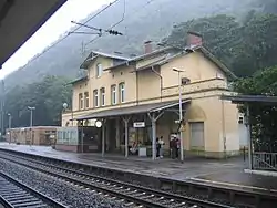 Train station | |
 Coat of arms | |
Location of Brohl-Lützing within Ahrweiler district 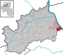 | |
 Brohl-Lützing  Brohl-Lützing | |
| Coordinates: 50°29′6″N 7°19′45″E / 50.48500°N 7.32917°E | |
| Country | Germany |
| State | Rhineland-Palatinate |
| District | Ahrweiler |
| Municipal assoc. | Bad Breisig |
| Government | |
| • Mayor (2019–24) | Frank Gondert[1] |
| Area | |
| • Total | 9.23 km2 (3.56 sq mi) |
| Elevation | 70 m (230 ft) |
| Population (2021-12-31)[2] | |
| • Total | 2,520 |
| • Density | 270/km2 (710/sq mi) |
| Time zone | UTC+01:00 (CET) |
| • Summer (DST) | UTC+02:00 (CEST) |
| Postal codes | 56656 |
| Dialling codes | 02633 (Brohl), 02636 (Niederlützingen) |
| Vehicle registration | AW |

Brohl-Lützing
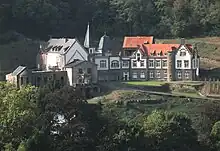
Castle „Augustaburg“
Brohl-Lützing is a municipality in the district of Ahrweiler in Rhineland-Palatinate, Germany.
 Rheinburgenweg Trail and Rheinhöhenweg Trail
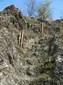 Hiking trail „Eselstreppe“
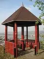 Viewpoint
References
- ↑ Direktwahlen 2019, Landkreis Ahrweiler, Landeswahlleiter Rheinland-Pfalz, accessed 3 August 2021.
- ↑ "Bevölkerungsstand 2021, Kreise, Gemeinden, Verbandsgemeinden" (in German). Statistisches Landesamt Rheinland-Pfalz. 2022.
This article is issued from Wikipedia. The text is licensed under Creative Commons - Attribution - Sharealike. Additional terms may apply for the media files.